Latitude: 51.1575 / 51°9'26"N
Longitude: 0.7468 / 0°44'48"E
OS Eastings: 592173
OS Northings: 143390
OS Grid: TQ921433
Mapcode National: GBR RWJ.9ML
Mapcode Global: VHKKK.W5NH
Plus Code: 9F325P4W+XP
Entry Name: The Dering Arms Inn
Listing Date: 10 October 1980
Grade: II
Source: Historic England
Source ID: 1071426
English Heritage Legacy ID: 181118
Also known as: The Dering Arms, Ashford
Dering Arms
ID on this website: 101071426
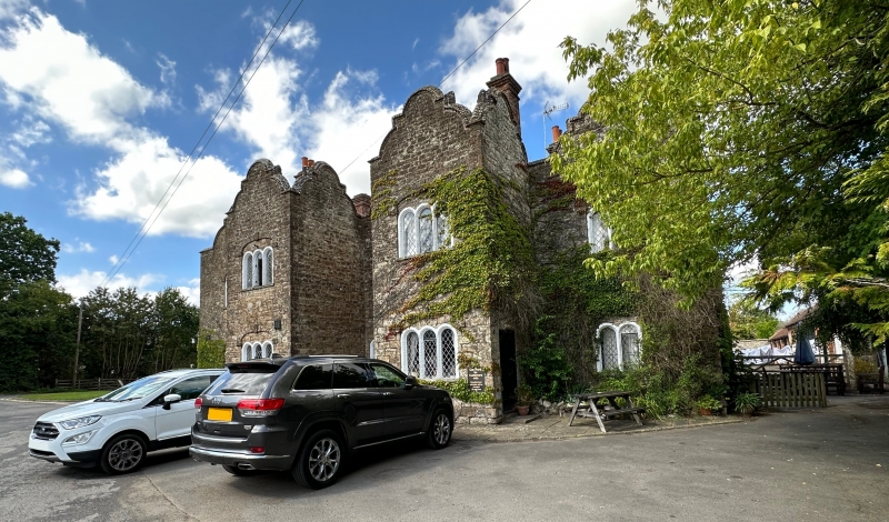
1. 5272 PLUCKLEY STATION ROAD The Dering Arms Inn TQ 94 SW 14/138 II 2. Circa 1840. Inspired by Surrenden Dering mansion. Two storeys ashlar. Two square projections with a shaped Dutch gable above each of their 3 faces. Five windows. Similar gables above the other 3 window bays. Five Dering windows with stone cambered head linings above the round-headed lights, with keyblocks at the angles and in the centre of the heads. Doorcase with flat hood over.
Listing NGR: TQ9217343390
External links are from the relevant listing authority and, where applicable, Wikidata. Wikidata IDs may be related buildings as well as this specific building. If you want to add or update a link, you will need to do so by editing the Wikidata entry.


Other nearby listed buildings