Latitude: 52.6496 / 52°38'58"N
Longitude: -1.1365 / 1°8'11"W
OS Eastings: 458513
OS Northings: 306115
OS Grid: SK585061
Mapcode National: GBR FGD.22
Mapcode Global: WHDJB.JN0L
Plus Code: 9C4WJVX7+R9
Entry Name: Abbot Penny's Wall
Listing Date: 14 March 1975
Last Amended: 16 January 1991
Grade: I
Source: Historic England
Source ID: 1361406
English Heritage Legacy ID: 188561
ID on this website: 101361406
Location: Abbey Park, Frog Island, Leicester, Leicestershire, LE4
County: City of Leicester
Electoral Ward/Division: Abbey
Parish: Non Civil Parish
Built-Up Area: Leicester
Traditional County: Leicestershire
Lieutenancy Area (Ceremonial County): Leicestershire
Church of England Parish: Leicester The Abbey
Church of England Diocese: Leicester
Tagged with: Architectural structure
In the entry for:- ABBEY PARK 1. 5304 Abbot Penny's Wall, forming West and North Boundary to Abbey Lane and Abbey Park Road and East Boundary along River Soar SK 5805 4/207 SK 50 NE 14/207 II The entry shall be amended to read:-
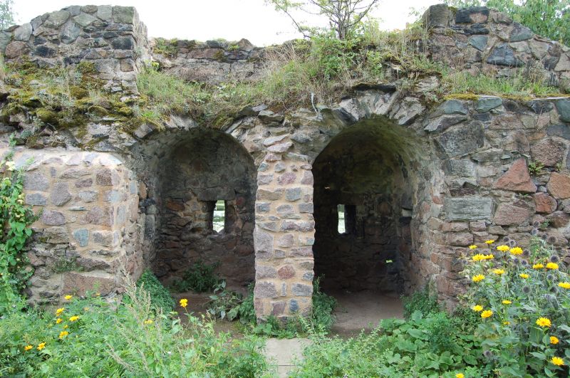
LEICESTER SK 50 NE ABBEY PARK 4-14/207 Abbot Penny's Wall GV I Monastic boundary wall, now park wall and gates. Medieval, c1500, mid C19 and 1931. Red and blue brick and Charnwood granite. From south east corner a 60 metre section of mid C19 brick wall, then a 45 metre section of repaired brick wall c1500. At the south west corner, a chamfered section with partial quoins and an ashlar niche with ornate canopy. The west wall c 1500, with blue brick patterned diaper work stretched 385 metres, with blue brick coping. 25 metres north a pair of square gate piers, c1980, then 100 metres north a further gateway, c1931, with a pair of square piers, short curved iron railings and a pair of square gatepiers with iron gates. 75 metres north an original four-centred archway now blocked. 185 metres north the wall becomes Charnwood granite rubble with rounded coping, slightly higher and largely medieval. 220 metres north a C20 gateway. 20 metres further north another gateway, c1931, with round outer piers, iron railings and octagonal ashlar gatepiers with iron gates. 75 metres north the wall curves round onto Abbey Park Road, and stretches 125 metres east to the main gateway. Entrance gate has outer octagonal turrets with ashlar battlements, and outer four-centred arches with a central larger four-centred arch topped by a coat-of-arms and a coped gable, all with iron gates. The wall continues 125 metres east to a chamfered turret, then a further 90 metres to a rounded corner turret. Fragmentary wall continues south along the River Soar for 323 metres, the wall has medieval windows and a restored turret with machicolations. At the south east corner a further turret also with medieval openings. The wall then stretches west for 57 metres with a central opening, and a small section turns north for 9 metres.
------------------------------------
ABBEY PARK 1. 5304 Abbot Penny's Wall, forming West and North Boundary to Abbey Lane and Abbey Park Road and East Boundary along River Soar SK 5805 4/207 SK 50 NE 14/207 II 2. Circa 1500. Stone rubble walls. The west wall along Abbey Lane heightened C17/C18? in red brick, with ramp coping of engineering bricks above.
Listing NGR: SK5851306115
External links are from the relevant listing authority and, where applicable, Wikidata. Wikidata IDs may be related buildings as well as this specific building. If you want to add or update a link, you will need to do so by editing the Wikidata entry.


Other nearby listed buildings