Approximate Location Map
Large Map »
Latitude: 52.6525 / 52°39'8"N
Longitude: -0.4778 / 0°28'39"W
OS Eastings: 503073
OS Northings: 307168
OS Grid: TF030071
Mapcode National: GBR FVS.L1Q
Mapcode Global: WHGLX.MLQF
Plus Code: 9C4XMG2C+XV
Entry Name: Church of St Michael
Listing Date: 22 May 1954
Grade: II
Source: Historic England
Source ID: 1168253
English Heritage Legacy ID: 193558
ID on this website: 101168253
Location: Stamford, South Kesteven, Lincolnshire, PE9
County: Lincolnshire
District: South Kesteven
Civil Parish: Stamford
Built-Up Area: Stamford
Traditional County: Lincolnshire
Lieutenancy Area (Ceremonial County): Lincolnshire
Church of England Parish: Stamford St Mary
Church of England Diocese: Lincoln
Tagged with: Church building Gothic Revival
1.
1671 HIGH STREET
(South Side)
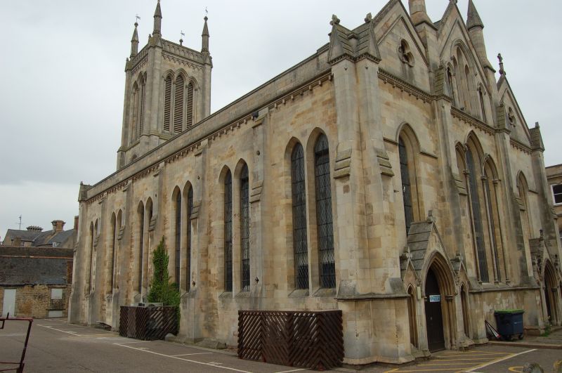
Church of St Michael
TF 0307 1/109 22.5.54.
II
2.
1836. Architect, John Brown of Norwich. Norman arch in undercroft, below west
Tower. Early English style. Octagonal Perpendicular font. Oak statuette, probably
Belgian C17 work. Not in ecclesiastical use at time of survey.
Listing NGR: TF0307307168
External links are from the relevant listing authority and, where applicable, Wikidata. Wikidata IDs may be related buildings as well as this specific building. If you want to add or update a link, you will need to do so by editing the Wikidata entry.


Other nearby listed buildings
