Approximate Location Map
Large Map »
Latitude: 51.4815 / 51°28'53"N
Longitude: 0.0358 / 0°2'8"E
OS Eastings: 541463
OS Northings: 177807
OS Grid: TQ414778
Mapcode National: GBR MQ.7QZ
Mapcode Global: VHHNQ.K1T2
Plus Code: 9F32F2JP+J8
Entry Name: Churchyard Walls, Gate Piers and Gate to St Luke's Church
Listing Date: 8 June 1973
Grade: II
Source: Historic England
Source ID: 1218584
English Heritage Legacy ID: 200249
ID on this website: 101218584
Location: St Luke's Church, Charlton, Greenwich, London, SE7
County: London
District: Greenwich
Electoral Ward/Division: Charlton
Parish: Non Civil Parish
Built-Up Area: Greenwich
Traditional County: Kent
Lieutenancy Area (Ceremonial County): Greater London
Church of England Parish: Charlton St Luke with Holy Trinity
Church of England Diocese: Southwark
Tagged with: Churchyard wall
1.
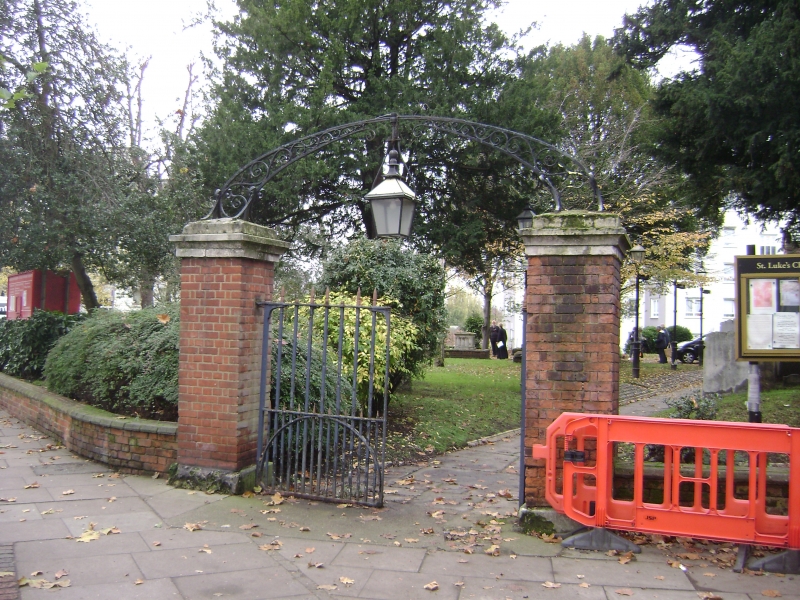
4412 CHARLTON CHURCH LANE SE7
Churchyard walls, gate piers
and gate to St Luke's Church
TQ 4177 29/G3A
II
2.
Low, stone-coped red brick walls. Square brick gate piers. Wrought iron gate
with overthrow at East end.
Listing NGR: TQ4146377807
External links are from the relevant listing authority and, where applicable, Wikidata. Wikidata IDs may be related buildings as well as this specific building. If you want to add or update a link, you will need to do so by editing the Wikidata entry.


Other nearby listed buildings
