Approximate Location Map
Large Map »
Latitude: 51.5033 / 51°30'11"N
Longitude: -0.1925 / 0°11'33"W
OS Eastings: 525548
OS Northings: 179806
OS Grid: TQ255798
Mapcode National: GBR 0H.Z9
Mapcode Global: VHGQY.MG2Y
Plus Code: 9C3XGR34+8X
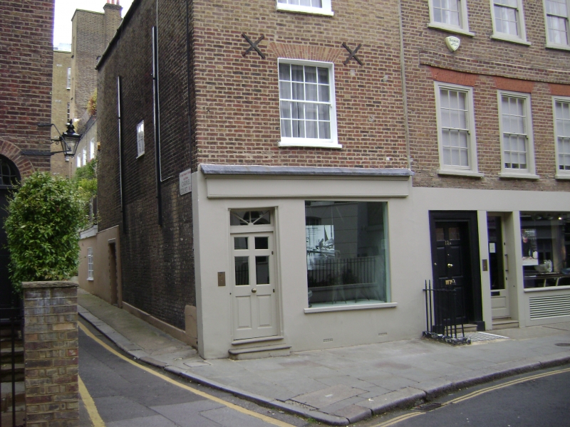
Entry Name: 14, Holland Street W8
Listing Date: 15 April 1969
Grade: II
Source: Historic England
Source ID: 1358203
English Heritage Legacy ID: 203951
ID on this website: 101358203
Location: Kensington, Kensington and Chelsea, London, W8
County: London
District: Kensington and Chelsea
Electoral Ward/Division: Campden
Parish: Non Civil Parish
Built-Up Area: Kensington and Chelsea
Traditional County: Middlesex
Lieutenancy Area (Ceremonial County): Greater London
Church of England Parish: St Mary Abbots with Christ Church and St Philip Kensington
Church of England Diocese: London
Tagged with: Building
TQ 2479 NE HOLLAND STREET W8
31/3
15.4.69 No 14
GV
II
House. C18. Three storeys, brown brick. One sash, parapet. Shop. Group value.
Listing NGR: TQ2554879806
External links are from the relevant listing authority and, where applicable, Wikidata. Wikidata IDs may be related buildings as well as this specific building. If you want to add or update a link, you will need to do so by editing the Wikidata entry.


Other nearby listed buildings
