Approximate Location Map
Large Map »
Latitude: 51.5683 / 51°34'6"N
Longitude: 0.0464 / 0°2'47"E
OS Eastings: 541926
OS Northings: 187480
OS Grid: TQ419874
Mapcode National: GBR MJ.Y32
Mapcode Global: VHHN4.RVD2
Plus Code: 9F32H29W+8H
Entry Name: The Grotto
Listing Date: 20 December 1954
Grade: II
Source: Historic England
Source ID: 1183624
English Heritage Legacy ID: 204882
ID on this website: 101183624
Location: Wanstead Park, Redbridge, London, E11
County: London
District: Redbridge
Electoral Ward/Division: Wanstead
Parish: Non Civil Parish
Traditional County: Essex
Lieutenancy Area (Ceremonial County): Greater London
Church of England Parish: Wanstead St Mary with Christ Church
Church of England Diocese: Chelmsford
Tagged with: Grotto
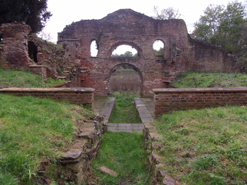
WANSTEAD PARK
1.
5027
E11
The Grotto
TQ 48 NW 5/18 20.12.54
II GV
2.
Circa 1762 (VCH). Large honeycomb rockwork facade of segmental plan, having
7 arches at lake level, and 3 windows above. The structure rises in pediment
form.
Listing NGR: TQ4192687480
External links are from the relevant listing authority and, where applicable, Wikidata. Wikidata IDs may be related buildings as well as this specific building. If you want to add or update a link, you will need to do so by editing the Wikidata entry.


Other nearby listed buildings
