Approximate Location Map
Large Map »
Latitude: 53.4017 / 53°24'6"N
Longitude: -2.9953 / 2°59'43"W
OS Eastings: 333921
OS Northings: 389896
OS Grid: SJ339898
Mapcode National: GBR 72Q.2K
Mapcode Global: WH876.YRTJ
Plus Code: 9C5VC223+MV
Entry Name: Sea Wall to Canning Island
Listing Date: 19 June 1985
Grade: II
Source: Historic England
Source ID: 1068361
English Heritage Legacy ID: 213808
ID on this website: 101068361
Location: Liverpool, Merseyside, L3
County: Liverpool
Electoral Ward/Division: Central
Parish: Non Civil Parish
Built-Up Area: Liverpool
Traditional County: Lancashire
Lieutenancy Area (Ceremonial County): Merseyside
Church of England Parish: Liverpool Our Lady and St Nicholas
Church of England Diocese: Liverpool
Tagged with: Wall
SJ 38 NW
6/193
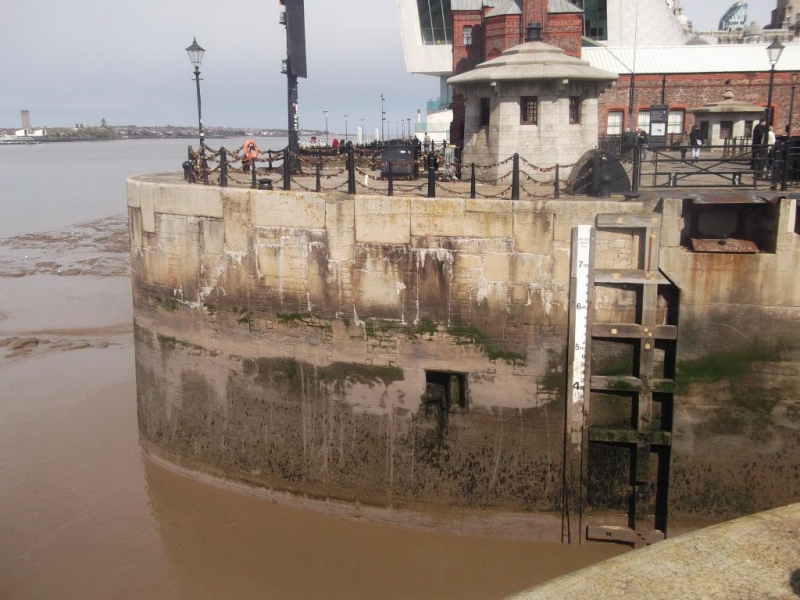
CANNING HALF-TIDE DOCK L3
Sea wall to Canning Island
G.V.
II
Sea wall. 1844. J. Hartley. Granite rubble brought to a
fair face and laid in blocks of greatly differing sizes.
Listing NGR: SJ3392189896
External links are from the relevant listing authority and, where applicable, Wikidata. Wikidata IDs may be related buildings as well as this specific building. If you want to add or update a link, you will need to do so by editing the Wikidata entry.


Other nearby listed buildings
