Latitude: 53.3509 / 53°21'3"N
Longitude: -3.1194 / 3°7'9"W
OS Eastings: 325584
OS Northings: 384367
OS Grid: SJ255843
Mapcode National: GBR 6YNP.GH
Mapcode Global: WH76F.11VF
Plus Code: 9C5R9V2J+96
Entry Name: Irby Hall
Listing Date: 15 November 1962
Grade: II
Source: Historic England
Source ID: 1075368
English Heritage Legacy ID: 215635
ID on this website: 101075368
Location: Irby, Wirral, Merseyside, CH61
County: Wirral
Electoral Ward/Division: Greasby, Frankby and Irby
Parish: Non Civil Parish
Built-Up Area: Heswall
Traditional County: Cheshire
Lieutenancy Area (Ceremonial County): Merseyside
Church of England Parish: Thurstaston St Bartholomew
Church of England Diocese: Chester
Tagged with: Building
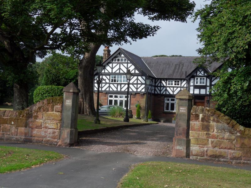
WIRRAL IRBY ROAD SJ 28 SE (west side) Irby 5/295 Irby Hall 15.11.62 II
House. Early C17 with entrance facade of 1888. Stone with slate roof, entrance facade has stone ground floor and timber-framed 1st floor replacing original timber-framed facade. 2 storeys, 4 bays, the end bays project under gables, the 3rd bay forms 2-storey gabled porch. 1st floor jettied on corbels. Trefoil-headed panels below 1st floor windows to end bays. Ground floor has 4:3:4-light casement windows with transoms. 1st floor has small-paned casements of 2 lights, 3-light windows to end bays, which have 4-light attic windows. Entrance has C20 8-panel door and original decorated timber above. Left return has one flush and one projecting lateral stack and 2-light double-chamfered- mullioned windows. Right return has large projecting stack with 2-light mullioned window. Rear has gabled wings, mostly C20 casements and 2 mullioned windows.
Listing NGR: SJ2558484367
External links are from the relevant listing authority and, where applicable, Wikidata. Wikidata IDs may be related buildings as well as this specific building. If you want to add or update a link, you will need to do so by editing the Wikidata entry.


Other nearby listed buildings