Latitude: 52.9496 / 52°56'58"N
Longitude: 0.4936 / 0°29'37"E
OS Eastings: 567630
OS Northings: 342048
OS Grid: TF676420
Mapcode National: GBR P2V.5M2
Mapcode Global: WHKPF.K482
Plus Code: 9F42WFXV+RF
Entry Name: The Lighthouse
Listing Date: 20 September 1984
Grade: II
Source: Historic England
Source ID: 1171495
English Heritage Legacy ID: 221217
ID on this website: 101171495
Location: Old Hunstanton, King's Lynn and West Norfolk, Norfolk, PE36
County: Norfolk
District: King's Lynn and West Norfolk
Civil Parish: Hunstanton
Built-Up Area: Hunstanton
Traditional County: Norfolk
Lieutenancy Area (Ceremonial County): Norfolk
Church of England Parish: Hunstanton St Mary
Church of England Diocese: Norwich
Tagged with: Lighthouse
TF 64 SE HUNSTANTON LIGHTHOUSE LANE New Hunstanton 1/35 The Lighthouse.
- II
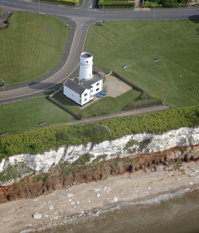
Former lighthouse and cottages attached to north. C.1830. Rendered stuccoed brick, slated roofs. Circular, battered tower of classical derived inspiration. 4 storeys. Coat of arms at base, single round headed windows to each floor. Massive modillion blocks form brackets for gallery with iron balcony encircling a canted top-storey with C20 termination above. Cottage attached to north, originally balanced by another to south since demolished. Gothick. 2 storey gable with ground-floor pedimented bay window, first floor cross window with drip mould. C20 casements inserted. Kneelers and coped parapets, roof replaced and stacks to north cut down. Door with rusticated dressings in wing connecting with lighthouse.
Listing NGR: TF6763042048
External links are from the relevant listing authority and, where applicable, Wikidata. Wikidata IDs may be related buildings as well as this specific building. If you want to add or update a link, you will need to do so by editing the Wikidata entry.


Other nearby listed buildings