Approximate Location Map
Large Map »
Latitude: 52.3666 / 52°21'59"N
Longitude: 1.1726 / 1°10'21"E
OS Eastings: 616090
OS Northings: 279024
OS Grid: TM160790
Mapcode National: GBR VKC.P7S
Mapcode Global: VHL98.8SR3
Plus Code: 9F43958F+M2
Entry Name: Remains of Church of St Mary, Thorpe Parva
Listing Date: 7 December 1959
Grade: II
Source: Historic England
Source ID: 1050243
English Heritage Legacy ID: 225683
ID on this website: 101050243
Location: Billingford, South Norfolk, IP21
County: Norfolk
District: South Norfolk
Town: South Norfolk
Civil Parish: Scole
Traditional County: Norfolk
Lieutenancy Area (Ceremonial County): Norfolk
Church of England Parish: Scole
Church of England Diocese: Norwich
Tagged with: Church ruin
l
5321 SCOLE BUNGAY ROAD
Scole
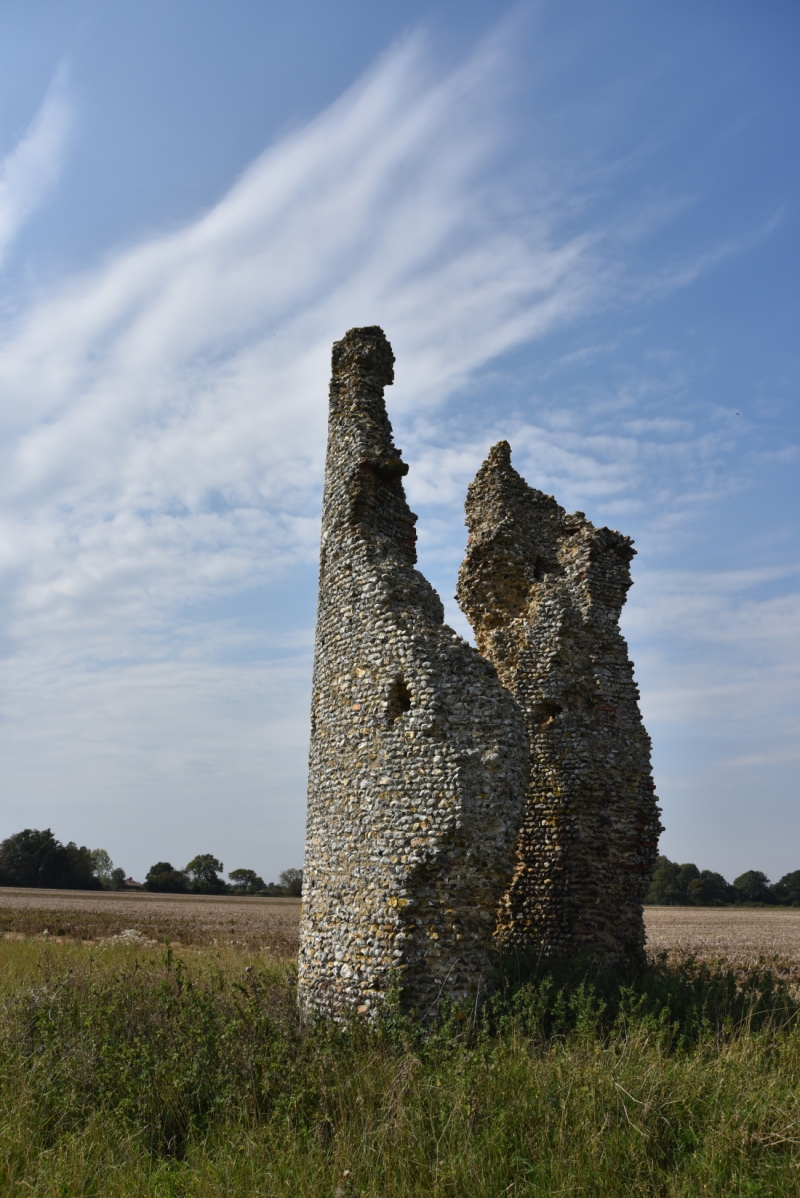
Remains of Church of
St Mary, Thorpe Parva
TM 17 NE 25/3A 7.12.59
II
2.
Ruin of C12 round tower. Only about half height and only south-west and
north-west sides remain. Flint rubble.
Listing NGR: TM1609079024
External links are from the relevant listing authority and, where applicable, Wikidata. Wikidata IDs may be related buildings as well as this specific building. If you want to add or update a link, you will need to do so by editing the Wikidata entry.


Other nearby listed buildings
