Latitude: 55.6101 / 55°36'36"N
Longitude: -1.7127 / 1°42'45"W
OS Eastings: 418197
OS Northings: 635199
OS Grid: NU181351
Mapcode National: GBR J3HK.0S
Mapcode Global: WHC0L.N8M3
Plus Code: 9C7WJ76P+2W
Entry Name: Windmill at North End of Bamburgh Castle
Listing Date: 26 August 1987
Grade: II
Source: Historic England
Source ID: 1370967
English Heritage Legacy ID: 237849
ID on this website: 101370967
Location: Bamburgh, Northumberland, NE69
County: Northumberland
Civil Parish: Bamburgh
Traditional County: Northumberland
Lieutenancy Area (Ceremonial County): Northumberland
Church of England Parish: Bamburgh St Aidan
Church of England Diocese: Newcastle
Tagged with: Windmill
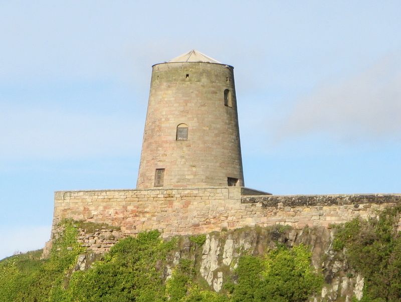
BAMBURGH BAMBURGH VILLAGE NU 13 NE 4/29 Windmill at north end of Bamburgh Castle GV II Windmill. Mid C18, for Dr. Sharpe, chairman of the Crewe Trustees. Ashlar with lead roof. 3 storeys, round with tapering profile. Boarded and battened door on ground floor. Various small 4-pane segment-headed windows above. Low pyramidal roof.
Listing NGR: NU1819735199
External links are from the relevant listing authority and, where applicable, Wikidata. Wikidata IDs may be related buildings as well as this specific building. If you want to add or update a link, you will need to do so by editing the Wikidata entry.


Other nearby listed buildings