Approximate Location Map
Large Map »
Latitude: 51.764 / 51°45'50"N
Longitude: -1.2117 / 1°12'42"W
OS Eastings: 454500
OS Northings: 207553
OS Grid: SP545075
Mapcode National: GBR 8Z0.6J9
Mapcode Global: VHCXN.YX9L
Plus Code: 9C3WQQ7Q+J8
Entry Name: 9, the Croft
Listing Date: 28 June 1972
Grade: II
Source: Historic England
Source ID: 1369367
English Heritage Legacy ID: 245428
ID on this website: 101369367
Location: Headington, Oxford, Oxfordshire, OX3
County: Oxfordshire
District: Oxford
Electoral Ward/Division: Headington
Parish: Non Civil Parish
Built-Up Area: Oxford
Traditional County: Oxfordshire
Lieutenancy Area (Ceremonial County): Oxfordshire
Church of England Parish: Headington St Andrew
Church of England Diocese: Oxford
Tagged with: Building
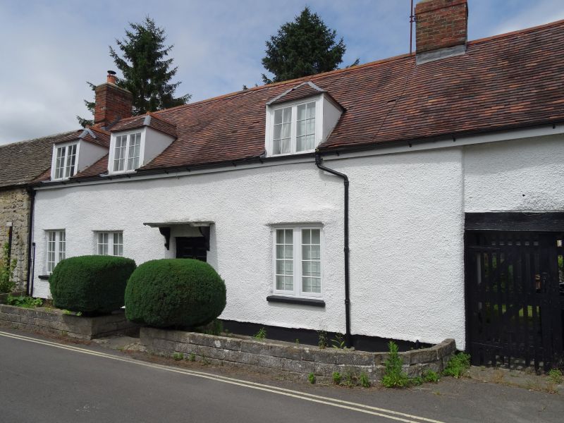
1. THE CROFT
1485
No 9
SP 5407 18/711
II
2.
Probably C18. Rubble. 1 storey and attic, 3 windows, casements, 3 gabled
dormers. Carriage arch on right, 6-panel door with flat hood. Modern tile
roof.
Listing NGR: SP5450007553
External links are from the relevant listing authority and, where applicable, Wikidata. Wikidata IDs may be related buildings as well as this specific building. If you want to add or update a link, you will need to do so by editing the Wikidata entry.


Other nearby listed buildings
