Approximate Location Map
Large Map »
Latitude: 51.532 / 51°31'55"N
Longitude: -0.977 / 0°58'37"W
OS Eastings: 471054
OS Northings: 181948
OS Grid: SU710819
Mapcode National: GBR B3B.ZRX
Mapcode Global: VHDWF.0RVG
Plus Code: 9C3XG2JF+Q5
Entry Name: Cottage Approximately 30 Metres East of the Dog Public House
Listing Date: 13 February 1985
Grade: II
Source: Historic England
Source ID: 1181315
English Heritage Legacy ID: 247167
ID on this website: 101181315
Location: Rotherfield Peppard, South Oxfordshire, RG9
County: Oxfordshire
District: South Oxfordshire
Civil Parish: Rotherfield Peppard
Built-Up Area: Rotherfield Peppard
Traditional County: Oxfordshire
Lieutenancy Area (Ceremonial County): Oxfordshire
Church of England Parish: Rotherfield Peppard
Church of England Diocese: Oxford
Tagged with: Cottage
ROTHERFIELD PEPPARD
SU78SW
6/145 Cottage approx 30 metres east
of the Dog Public House
- II
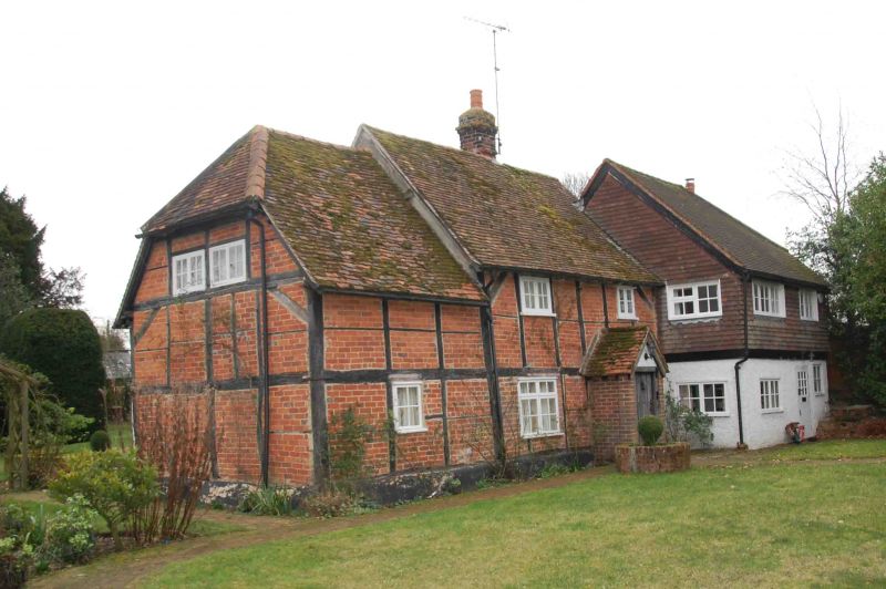
Cottage. C17 with later alterations. Large timber framing; brick infill;
plain old tile roof; brick ridge stack. 2-unit plan with wing to left. 2
storey, 2-window range with 1 storey and attic wing to left. Central plank
door. 2 casements to ground and first floor. Single casement to wing.
Gabled roof with lower half-hipped roof to wing. Interior not inspected. C20
two storey wing to right.
Listing NGR: SU7105481948
External links are from the relevant listing authority and, where applicable, Wikidata. Wikidata IDs may be related buildings as well as this specific building. If you want to add or update a link, you will need to do so by editing the Wikidata entry.


Other nearby listed buildings
