Latitude: 51.4858 / 51°29'8"N
Longitude: -1.0374 / 1°2'14"W
OS Eastings: 466936
OS Northings: 176750
OS Grid: SU669767
Mapcode National: GBR Q42.4V
Mapcode Global: VHCZ3.YXYD
Plus Code: 9C3WFXP7+82
Entry Name: The Mill
Listing Date: 24 October 1951
Grade: II*
Source: Historic England
Source ID: 1059523
English Heritage Legacy ID: 247416
ID on this website: 101059523
Location: Mapledurham, South Oxfordshire, RG8
County: Oxfordshire
District: South Oxfordshire
Civil Parish: Mapledurham
Traditional County: Oxfordshire
Lieutenancy Area (Ceremonial County): Oxfordshire
Church of England Parish: Caversham Thameside and Mapledurham
Church of England Diocese: Oxford
Tagged with: Mill
MAPLEDURHAM THE STREET SU67NE (West side) 9/198 The Mill 24/10/51
GV II*
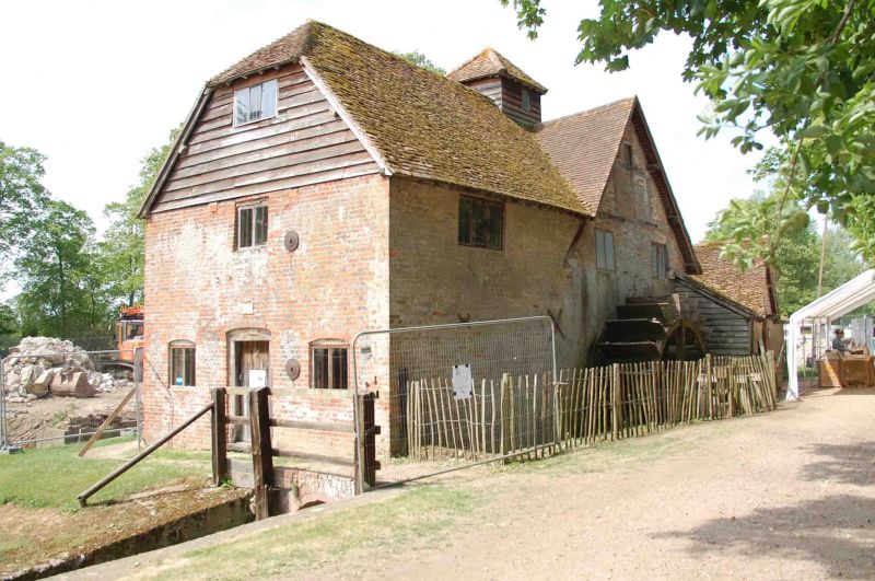
Watermill. C15; extended C17, C18 and C19. Red brick with random grey headers; weatherboarding; plain tile roof. Complex plan. 2 storeys and attic; 3-window range. Central plank door with 2-light windows to left and right with segmental brick heads. Single window to first floor. Weatherboarding to half-hipped cross-gable to roof with 3-light window. Weatherboarded sack hoist; cupola with pyramidal tile roof to centre. Subsidiary wing to left of single storey and attic; with single window to ground floor. gabled dormer. Interior: Timber framing, part probably a survival from the C15 mill. Good collection of mill machinery. (G. Williams: Mapledurham Watermill Guidebook 1980).
Listing NGR: SU6693276748
External links are from the relevant listing authority and, where applicable, Wikidata. Wikidata IDs may be related buildings as well as this specific building. If you want to add or update a link, you will need to do so by editing the Wikidata entry.


Other nearby listed buildings