Latitude: 51.7472 / 51°44'49"N
Longitude: -0.9775 / 0°58'39"W
OS Eastings: 470685
OS Northings: 205878
OS Grid: SP706058
Mapcode National: GBR B0T.KMX
Mapcode Global: VHDVG.0BKZ
Plus Code: 9C3XP2WC+VX
Entry Name: The Birdcage Public House
Listing Date: 24 April 1951
Last Amended: 16 June 1988
Grade: II*
Source: Historic England
Source ID: 1047982
English Heritage Legacy ID: 248466
Also known as: The Birdcage, Thame
Birdcage
ID on this website: 101047982
Location: Thame, South Oxfordshire, OX9
County: Oxfordshire
District: South Oxfordshire
Civil Parish: Thame
Built-Up Area: Thame
Traditional County: Oxfordshire
Lieutenancy Area (Ceremonial County): Oxfordshire
Church of England Parish: Thame St Mary
Church of England Diocese: Oxford
Tagged with: Pub
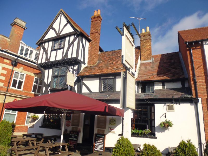
THAME CORNMARKET SP7005NE (North-east side) 10/39 No.4 (The Birdcage Public 24/04/51 House) (Formerly listed as The "Bird Cage" Hotel)
GV II*
Public house. Early C16 with probably aid C16 three-storey addition to left, late C18 lean-to addition to ground floor. Render, probably on brick to ground floor; slate roof to lean-to roof between ground and first floors; large timber framing with rendered infill; old plain-tile roofs; brick stacks. 2-storey, 2-window range with 3-storey single-window range to left. Sash doors to centre and to angled corner to left. Tripartite unhorned sashes with glazing bars to left and right. Horizontal sliding sash to right. Horizontal sliding lash to right. 2-light leaded casement to centre. Timber framing first floor left has unusual crossed tension braces. C20 two-light wood mullion and transom window to first floor left. Jettied second floor to left. 2-light casement to second floor. Gabled roof of 2 heights to centre and right. Gabled roof to left with gable end to street front. Left return: C16 wood angled oriels to first floor with Perpendicular tracery. Interior; spine-beams, dragon beams and joists visible to ground floor. Reputed to have cellars of pre C16 date. (Buildings of England: Oxfordshire, 1979, p.816).
Listing NGR: SP7069405875
External links are from the relevant listing authority and, where applicable, Wikidata. Wikidata IDs may be related buildings as well as this specific building. If you want to add or update a link, you will need to do so by editing the Wikidata entry.


Other nearby listed buildings