Approximate Location Map
Large Map »
Latitude: 52.5949 / 52°35'41"N
Longitude: -2.5551 / 2°33'18"W
OS Eastings: 362495
OS Northings: 299826
OS Grid: SO624998
Mapcode National: GBR BS.9PMW
Mapcode Global: WH9DM.Q1HH
Plus Code: 9C4VHCVV+XX
Entry Name: 7 and 8, Barrow Street
Listing Date: 1 February 1974
Grade: II
Source: Historic England
Source ID: 1294479
English Heritage Legacy ID: 254768
ID on this website: 101294479
Location: Much Wenlock, Shropshire, TF13
County: Shropshire
Civil Parish: Much Wenlock
Built-Up Area: Much Wenlock
Traditional County: Shropshire
Lieutenancy Area (Ceremonial County): Shropshire
Church of England Parish: Much Wenlock with Bourton
Church of England Diocese: Hereford
Tagged with: Building
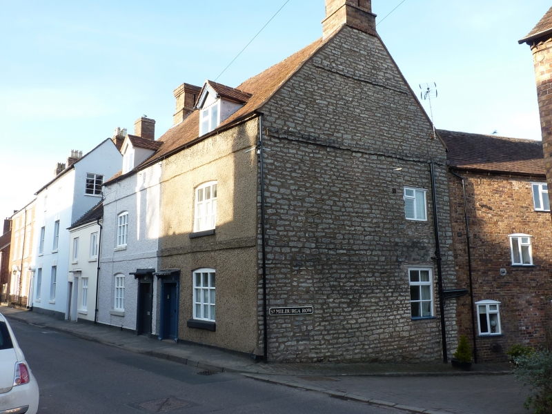
1.
1954 MUCH WENLOCK
BARROW STREET
(North Side)
Nos 7 and 8
SO 69 NW (SJ6200) 6/6
II GV
2.
Early C19, the core probably C18. Roughcast; 2 storeys and attic; 2 casement
windows (one later) with segmental heads; 2 simple wood pilaster doorcases
with cornice hoods; bands; plain eaves; tiles.
Nos 6 to 9 (consec) and 11 to 14 (consec) form a group
Listing NGR: SO6249799821
External links are from the relevant listing authority and, where applicable, Wikidata. Wikidata IDs may be related buildings as well as this specific building. If you want to add or update a link, you will need to do so by editing the Wikidata entry.


Other nearby listed buildings
