Approximate Location Map
Large Map »
Latitude: 52.7083 / 52°42'29"N
Longitude: -2.7126 / 2°42'45"W
OS Eastings: 351948
OS Northings: 312526
OS Grid: SJ519125
Mapcode National: GBR BL.2DVP
Mapcode Global: WH8BV.96J3
Plus Code: 9C4VP75P+8W
Entry Name: Bridge Number 438 (Belvedere Bridge)
Listing Date: 3 April 1985
Grade: II*
Source: Historic England
Source ID: 1177239
English Heritage Legacy ID: 259294
ID on this website: 101177239
Location: Shropshire, SY4
County: Shropshire
Civil Parish: Uffington
Built-Up Area: Shrewsbury
Traditional County: Shropshire
Lieutenancy Area (Ceremonial County): Shropshire
Church of England Parish: Uffington Holy Trinity
Church of England Diocese: Lichfield
Tagged with: Railway bridge Bridge
SJ 51 SW
SJ 5194 1253 UFFINGTON C.P. -
3/68 Bridge No.438
3/4/85 (Belvidere Bridge)
(that part in
Uffington C.P.)
- II*
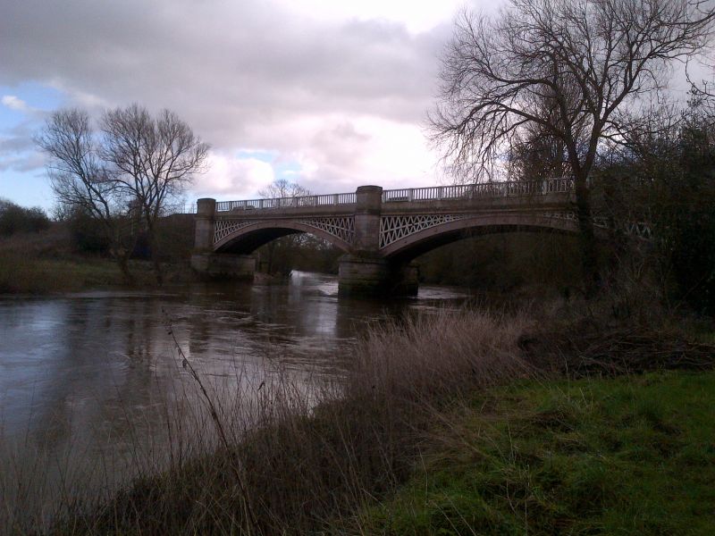
Railway bridge. Dated 1848, William Baker engineer; restored and
slightly altered in 1984. Chamfered rusticated grey sandstone ashlar
piers, engineering brick retaining walls and end piers with ashlar
dressings, and painted cast iron arches and decking. 2 segmental skew
arches, each consisting of 6 cast ribs with lattice spandrels; central
pier with rounded rock-faced cutwater; coped curved retaining walls
and square end piers with rock-faced ashlar quoins and stone caps;
late C20 balustrade replacing 1848 one. Maker's plate on eastern
arch to south: "CAST AT COALBROOKDALE FOUNDRY 1848"; shield-shaped
plaques on central pier to south: "WILLIAM BAKER ESQ/ENGINEER/1848",
and to north: "HAMMOND AND MURRAY/CONTRACTOR/1848". There are also
datestones on the railway side of the parapets to the central pier.
Each of the ribs is made up from short cast sections bolted together.
The Shrewsbury to Oakengates section of the Shrewsbury and Birmingham
Railway was opened on June 1st, 1849 and the whole of the line to
Wolverhampton on November 12th of the same year. The original estimate
for the bridge was £80,000, and it was formerly numbered 4 on the
Shrewsbury-Wellington Line. The bridge spans the River Severn. Rex
Christiansen, A Regional History of the Railways of Great Britain,
Vol.7 The West Midlands, David and Charles (1983), Pp.80-95; Richard
K. Morriss, Railways of Shropshire: a brief history, Shropshire
Libraries (1983), Pp.17-23 and p.72 (i11.); Shropshire Railway
Society, Shropshire Railways Revisited, Shropshire Libraries (1982),
i11.26.
Listing NGR: SJ5194812526
External links are from the relevant listing authority and, where applicable, Wikidata. Wikidata IDs may be related buildings as well as this specific building. If you want to add or update a link, you will need to do so by editing the Wikidata entry.


Other nearby listed buildings
