Approximate Location Map
Large Map »
Latitude: 51.1476 / 51°8'51"N
Longitude: -2.7117 / 2°42'42"W
OS Eastings: 350311
OS Northings: 138940
OS Grid: ST503389
Mapcode National: GBR MK.7YM7
Mapcode Global: VH8B3.YF84
Plus Code: 9C3V47XQ+28
Entry Name: 15, Lambrook Street
Listing Date: 25 October 1973
Grade: II
Source: Historic England
Source ID: 1345443
English Heritage Legacy ID: 265961
ID on this website: 101345443
Location: Glastonbury, Somerset, BA6
County: Somerset
District: Mendip
Civil Parish: Glastonbury
Built-Up Area: Glastonbury
Traditional County: Somerset
Lieutenancy Area (Ceremonial County): Somerset
Tagged with: Building
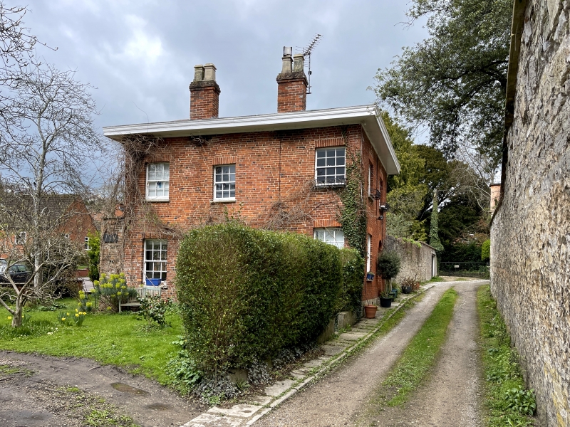
LAMBROOK STREET
1.
1133
(East Side)
No 15
ST 5038 8/157 25.10.73.
II GV
2.
Early/mid C19. 2 storeys. Red brick. Deep eaves. Double hipped pantile roofs
with twin brick stacks. 3 windows, symmetrically placed. Sashes in plain reveals
with thin glazing bars. Entrance is up drive to right. Semi-circular fanlight
with tracery. 6-panel door.
No 15, Combe Brook and the Vicarage form a group.
Listing NGR: ST5031138940
External links are from the relevant listing authority and, where applicable, Wikidata. Wikidata IDs may be related buildings as well as this specific building. If you want to add or update a link, you will need to do so by editing the Wikidata entry.


Other nearby listed buildings
