Approximate Location Map
Large Map »
Latitude: 53.1818 / 53°10'54"N
Longitude: -1.8674 / 1°52'2"W
OS Eastings: 408960
OS Northings: 364973
OS Grid: SK089649
Mapcode National: GBR 358.GQQ
Mapcode Global: WHCDB.9903
Plus Code: 9C5W54JM+P3
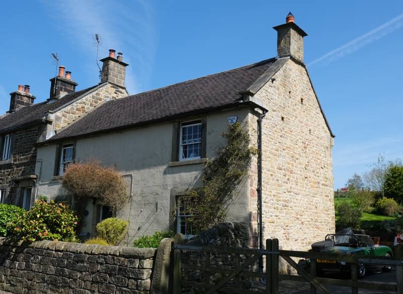
Entry Name: The Cottage
Listing Date: 5 June 1985
Grade: II
Source: Historic England
Source ID: 1038204
English Heritage Legacy ID: 274275
ID on this website: 101038204
Location: Longnor, Staffordshire Moorlands, Staffordshire, SK17
County: Staffordshire
District: Staffordshire Moorlands
Civil Parish: Longnor
Traditional County: Staffordshire
Lieutenancy Area (Ceremonial County): Staffordshire
Church of England Parish: Longnor St Bartholomew
Church of England Diocese: Lichfield
Tagged with: Cottage
SK 06 SE
5/61
LONGNOR C.P.
CHURCH STREET
The Cottage
GV
II
House. Early C19. Rendered and lined as ashlar; blue machine tile
roof; verge parapets, stone end stack with moulded cappings. Two
storeys, two widely-spaced glazing bar sashes; surround and hood to
C20 boarded door, set to left of centre.
Listing NGR: SK0896064973
External links are from the relevant listing authority and, where applicable, Wikidata. Wikidata IDs may be related buildings as well as this specific building. If you want to add or update a link, you will need to do so by editing the Wikidata entry.


Other nearby listed buildings
