Approximate Location Map
Large Map »
Latitude: 52.0349 / 52°2'5"N
Longitude: 0.7209 / 0°43'15"E
OS Eastings: 586730
OS Northings: 240883
OS Grid: TL867408
Mapcode National: GBR QHJ.H26
Mapcode Global: VHKF9.F3ZW
Plus Code: 9F422PMC+X9
Entry Name: 1-6, Ballingdon Street
Listing Date: 3 March 1952
Grade: II
Source: Historic England
Source ID: 1037551
English Heritage Legacy ID: 275922
ID on this website: 101037551
Location: Ballingdon, Babergh, Suffolk, CO10
County: Suffolk
District: Babergh
Civil Parish: Sudbury
Built-Up Area: Sudbury
Traditional County: Essex
Lieutenancy Area (Ceremonial County): Suffolk
Church of England Parish: Sudbury All Saints
Church of England Diocese: St.Edmundsbury and Ipswich
Tagged with: Building
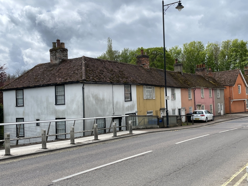
1. BALLINGDON STREET
1692 (South-East Side)
Nos 1 to 6 (consec)
TL 8640 4/24 5.5.52.
II GV
Z.
C17/Cl8 cottages adjoining Ballingdon Bridge, and picturesque. 2 storey,
timber-framed and plastered, roofs tiled. L-shaped. 7 window range, sashes
with glazing bars. Ground floor, part with weather-boarded base.
Nos 1 to 6 (consec) and Brioge House form a group.
Listing NGR: TL8673040883
External links are from the relevant listing authority and, where applicable, Wikidata. Wikidata IDs may be related buildings as well as this specific building. If you want to add or update a link, you will need to do so by editing the Wikidata entry.


Other nearby listed buildings
