Latitude: 51.9655 / 51°57'55"N
Longitude: 1.224 / 1°13'26"E
OS Eastings: 621576
OS Northings: 234580
OS Grid: TM215345
Mapcode National: GBR VQ8.Q9N
Mapcode Global: VHLC7.5VGM
Plus Code: 9F33X68F+6J
Entry Name: Queens House
Listing Date: 13 August 1988
Grade: II
Source: Historic England
Source ID: 1351637
English Heritage Legacy ID: 277427
ID on this website: 101351637
Location: Erwarton, Babergh, Suffolk, IP9
County: Suffolk
District: Babergh
Civil Parish: Arwarton
Traditional County: Suffolk
Lieutenancy Area (Ceremonial County): Suffolk
Church of England Parish: Erwarton St Mary the Virgin
Church of England Diocese: St.Edmundsbury and Ipswich
Tagged with: Pub
This list entry was subject to a Minor Amendment on 15 January 2026 to amend the name, address and description due to a change in building use and reformat the text to current standards
TM 23 SW
6/8
ERWARTON
QUEENS ROAD
Queens House
(Formerly listed as Queen's Head Public House, THE STREET)
19/8/88
II
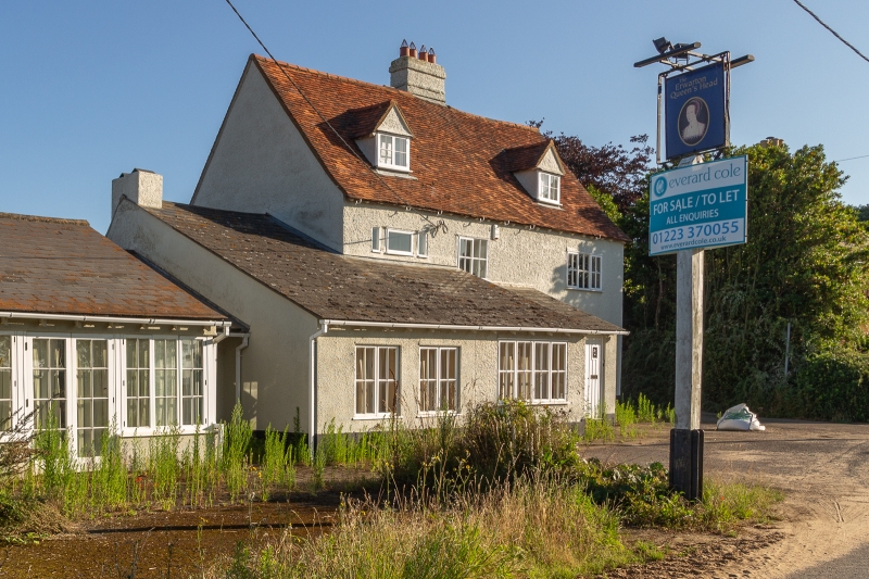
Former public house. C17 or earlier with later alterations and additions. Timber framed and rough rendered. Red plain tiled roof. Central red brick chimney stack. Two storeys and attics with single storey left extension bake-house, chimney stack to left and forward left lean-to extension with grey slate roof. Lobby entrance plan of three bays. Two first floor and ground floor various casements and a large C20 casement to left lean-to extension, single casement to left bakehouse. Central vertically-boarded door, moulded surround, flat canopy on brackets, similar door and surround to left bakehouse.
Listing NGR: TM2157634580
External links are from the relevant listing authority and, where applicable, Wikidata. Wikidata IDs may be related buildings as well as this specific building. If you want to add or update a link, you will need to do so by editing the Wikidata entry.


Other nearby listed buildings