Latitude: 52.3358 / 52°20'8"N
Longitude: 0.8065 / 0°48'23"E
OS Eastings: 591304
OS Northings: 274563
OS Grid: TL913745
Mapcode National: GBR RF9.DQS
Mapcode Global: VHKCS.XKQ7
Plus Code: 9F428RP4+8H
Entry Name: Honington Voluntary Controlled School
Listing Date: 14 December 1983
Grade: II
Source: Historic England
Source ID: 1031291
English Heritage Legacy ID: 284056
ID on this website: 101031291
Location: Honington, West Suffolk, IP31
County: Suffolk
District: West Suffolk
Civil Parish: Honington
Built-Up Area: Honington
Traditional County: Suffolk
Lieutenancy Area (Ceremonial County): Suffolk
Church of England Parish: Honington All Saints
Church of England Diocese: St.Edmundsbury and Ipswich
Tagged with: Building
TL 97 SW HONINGTON MALTING ROW (NORTH SIDE)
3/79 Honington Voluntary - Controlled School GV II
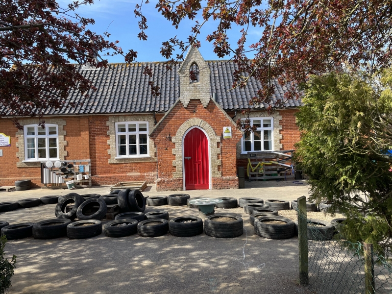
Primary school. 1863, with later extensions. Single-storey. Red brick, with slightly projecting rusticated white brick dressings. Glazed pantiled roof with stone copings to gables. The original building, in 3 bays, with a central enclosed gabled porch surmounted by a bell-cote, was extended by one bay in matching materials on the east, and subsequently by a further matching extension of one bay on the west. 3-light Tudoresque mullion-and-transome windows to each bay, and long windows in similar style to each gable end. A plank door with raised pilaster strips. Included for group value.
Listing NGR: TL9130474563
External links are from the relevant listing authority and, where applicable, Wikidata. Wikidata IDs may be related buildings as well as this specific building. If you want to add or update a link, you will need to do so by editing the Wikidata entry.


Other nearby listed buildings