Latitude: 50.8413 / 50°50'28"N
Longitude: -0.5148 / 0°30'53"W
OS Eastings: 504664
OS Northings: 105690
OS Grid: TQ046056
Mapcode National: GBR GKS.2NQ
Mapcode Global: FRA 96TW.18L
Plus Code: 9C2XRFRP+G3
Entry Name: St John's Priory
Listing Date: 12 October 1954
Last Amended: 20 September 1984
Grade: I
Source: Historic England
Source ID: 1217172
English Heritage Legacy ID: 298030
Also known as: Fairplace Farmhouse
ID on this website: 101217172
TQ 00 NW POLING POLING STREET 9/181 12.10.54 St John's Priory (formerly listed as Fairplace Farmhouse incorporating remains of St John's Priory)
I
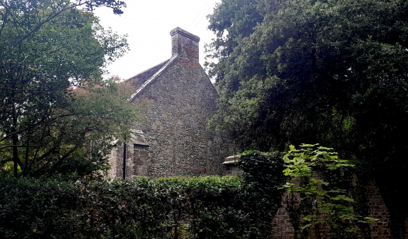
At one time called Fairplace Farmhouse. A Preceptory or Commandery of the Knights Hospitallers of St John of Jerusalem was founded here in C12. In 1541 it was suppressed and the buildings granted to Arundel College, which was itself suppressed in 1546. The surviving buildings consist of the C13 Chapel adapted into a dwelling in the C16 and altered about 1830. It is built of stone rubble, flints and red brick with some timber-framing exposed at the back. Four stone buttresses to the front. Horsham slab roof. Casement windows in deep reveals. Pointed stone doorway with archivolt and dripstone. 2 storeys, 4 windows. The east wall has flanking buttresses and a blocked pointed window. To the west is an extension of 2 window bays in red brick dating from about 1830.
Listing NGR: TQ0465905693
External links are from the relevant listing authority and, where applicable, Wikidata. Wikidata IDs may be related buildings as well as this specific building. If you want to add or update a link, you will need to do so by editing the Wikidata entry.


Other nearby listed buildings