Approximate Location Map
Large Map »
Latitude: 50.9087 / 50°54'31"N
Longitude: -0.5372 / 0°32'13"W
OS Eastings: 502942
OS Northings: 113158
OS Grid: TQ029131
Mapcode National: GBR GJS.WJG
Mapcode Global: FRA 96RP.Y9K
Plus Code: 9C2XWF57+F4
Entry Name: The Manse
Listing Date: 9 May 1980
Grade: II
Source: Historic England
Source ID: 1353928
English Heritage Legacy ID: 298229
ID on this website: 101353928
Location: Amberley, Horsham, West Sussex, BN18
County: West Sussex
District: Horsham
Civil Parish: Amberley
Built-Up Area: Amberley
Traditional County: Sussex
Lieutenancy Area (Ceremonial County): West Sussex
Church of England Parish: Amberley with North Stoke
Church of England Diocese: Chichester
Tagged with: Clergy house
AMBERLEY CHURCH STREET
1. (south side)
5404
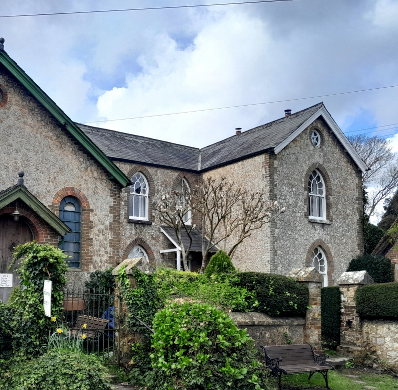
the Manse
TQ 0213 21/632
II
2.
Early C19 L-shaped house, 2 storeys, 3 windows. Stone rubble with red brick
dressings and quoins. Slate roof. The principal feature of the building comprises
the pointed sash windows with oriental glazing.
Listing NGR: TQ0294213160
External links are from the relevant listing authority and, where applicable, Wikidata. Wikidata IDs may be related buildings as well as this specific building. If you want to add or update a link, you will need to do so by editing the Wikidata entry.


Other nearby listed buildings
