Latitude: 54.9728 / 54°58'22"N
Longitude: -1.6149 / 1°36'53"W
OS Eastings: 424749
OS Northings: 564312
OS Grid: NZ247643
Mapcode National: GBR SP2.GC
Mapcode Global: WHC3R.588L
Plus Code: 9C6WX9FP+42
Entry Name: Grainger Market
Listing Date: 14 June 1954
Grade: I
Source: Historic England
Source ID: 1024866
English Heritage Legacy ID: 304574
ID on this website: 101024866
Location: Newcastle upon Tyne, Tyne and Wear, NE1
County: Newcastle upon Tyne
Electoral Ward/Division: Westgate
Parish: Non Civil Parish
Built-Up Area: Newcastle upon Tyne
Traditional County: Northumberland
Lieutenancy Area (Ceremonial County): Tyne and Wear
Church of England Parish: Newcastle St Andrew
Church of England Diocese: Newcastle
Tagged with: Market hall
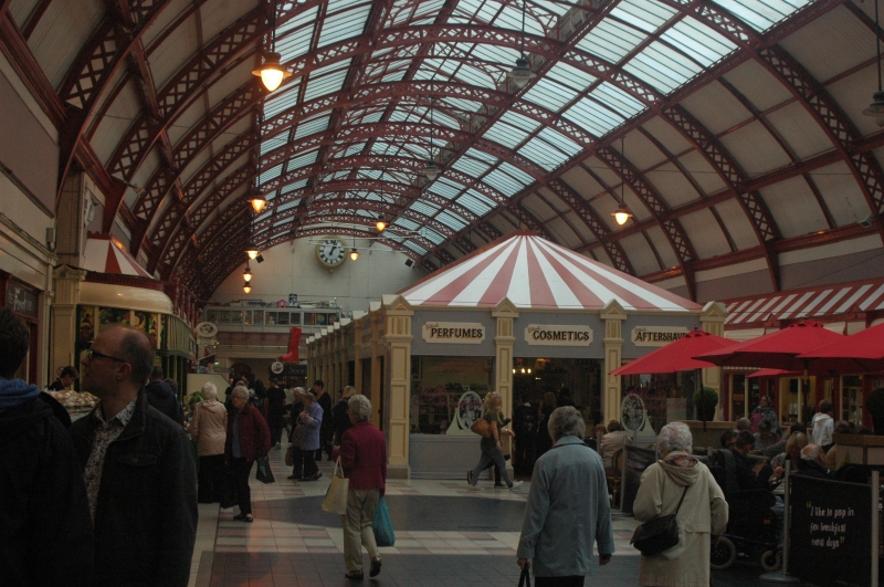
NZ 2464 SE NEWCASTLE UPON TYNE GRAINGER STREET (west side) 20/259 14.6.54 Grainger Market G.V. I Covered market. 1835 by John Dobson for Richard Grainger. Painted plaster with cast iron grilles; cast iron girder roof to west range, plaster to other ranges. Rear range a large rectangle, with bowed lattice girder roof and glazed roof- lights; other ranges a grid with open shops, many with iron grilles over, with pilasters defining bays, and with large shop numbers on fascia. Flat roofs with plastered cross beams; cross passages running from Granger Street have round-arched ceilings. Much original work visible, probably more remains behind boarded fascias. Walls above shops contain sashes with vertical glazing bars. An early covered market, built to replace the 1808 'Butcher Market' which Grainger had to demolish before Grey Street could be laid out. Source: Wilkes and Dodds Tyneside Classical 1964.
Listing NGR: NZ2474964311
External links are from the relevant listing authority and, where applicable, Wikidata. Wikidata IDs may be related buildings as well as this specific building. If you want to add or update a link, you will need to do so by editing the Wikidata entry.


Other nearby listed buildings