Approximate Location Map
Large Map »
Latitude: 51.2053 / 51°12'19"N
Longitude: -2.1827 / 2°10'57"W
OS Eastings: 387332
OS Northings: 145142
OS Grid: ST873451
Mapcode National: GBR 1V6.70Z
Mapcode Global: VH97H.3YYV
Plus Code: 9C3V6R48+4W
Entry Name: 28, High Street
Listing Date: 28 April 1952
Last Amended: 31 March 1978
Grade: II
Source: Historic England
Source ID: 1036214
English Heritage Legacy ID: 312926
ID on this website: 101036214
Location: Warminster, Wiltshire, BA12
County: Wiltshire
Civil Parish: Warminster
Built-Up Area: Warminster
Traditional County: Wiltshire
Lieutenancy Area (Ceremonial County): Wiltshire
Church of England Parish: Warminster St Denys
Church of England Diocese: Salisbury
Tagged with: Building
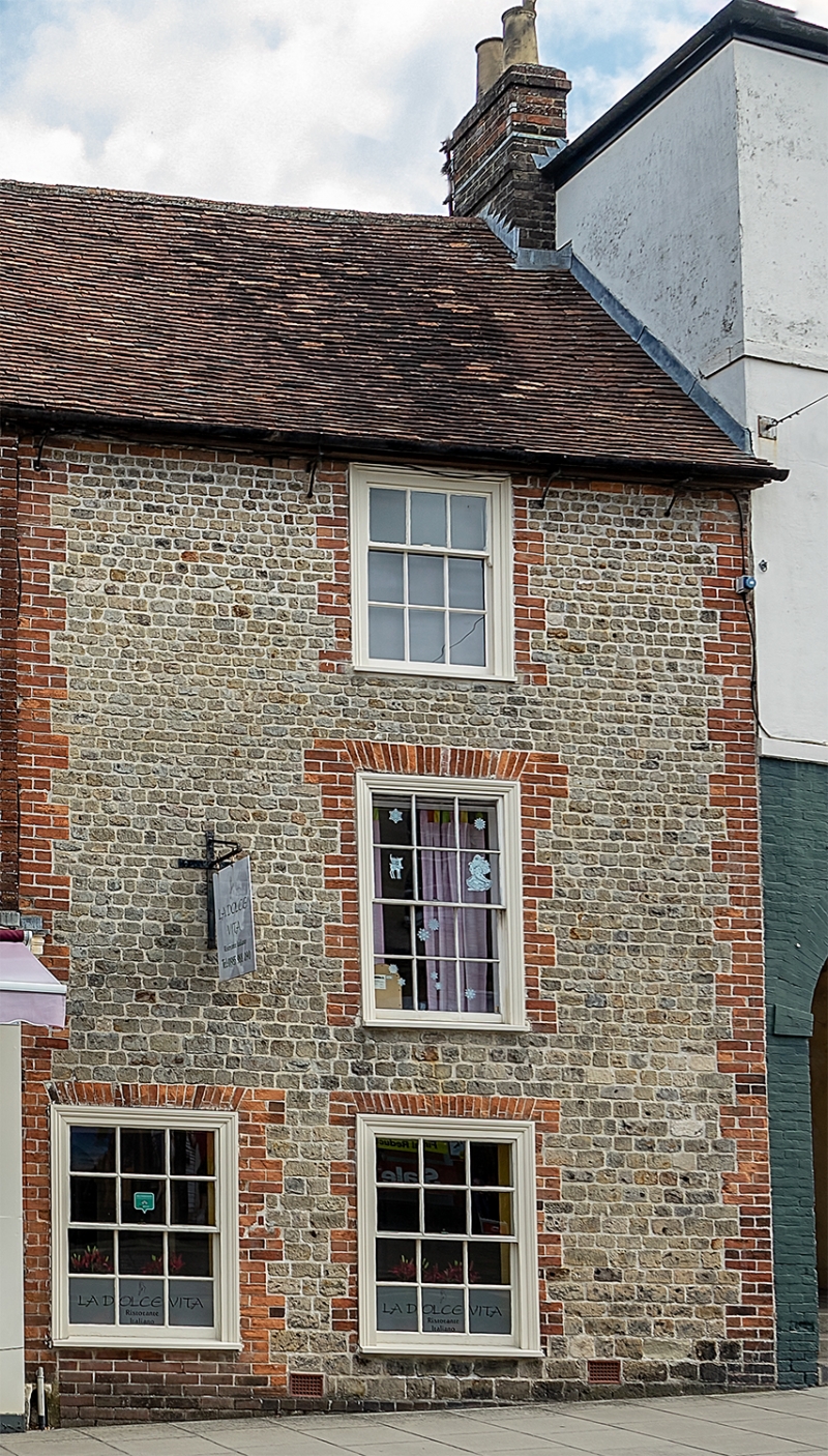
WARMINSTER HIGH STREET
1.
5411
(North Side)
No 28 (formerly
listed as No 26)
ST 8745 SW 6/27 28.4.52.
II GV
2.
Mid C18. 3 storeys. Coursed rubble with brick dressings and quoins. 1 range
of windows to right of centre, glazing bar sashes. 6 panel door with architrave
surround to left. Old tile roof, same eaves and ridge level as Nos 30 and
32.
Listing NGR: ST8733245142
External links are from the relevant listing authority and, where applicable, Wikidata. Wikidata IDs may be related buildings as well as this specific building. If you want to add or update a link, you will need to do so by editing the Wikidata entry.


Other nearby listed buildings
