Approximate Location Map
Large Map »
Latitude: 51.6466 / 51°38'47"N
Longitude: -1.9362 / 1°56'10"W
OS Eastings: 404507
OS Northings: 194206
OS Grid: SU045942
Mapcode National: GBR 3RR.P9J
Mapcode Global: VHB2Y.DW72
Plus Code: 9C3WJ3W7+MG
Entry Name: Gumstool Bridge
Listing Date: 17 January 1955
Grade: II
Source: Historic England
Source ID: 1023059
English Heritage Legacy ID: 317679
ID on this website: 101023059
Location: Ashton Keynes, Wiltshire, SN6
County: Wiltshire
Civil Parish: Ashton Keynes
Built-Up Area: Ashton Keynes
Traditional County: Wiltshire
Lieutenancy Area (Ceremonial County): Wiltshire
Church of England Parish: Ashton Keynes
Church of England Diocese: Bristol
Tagged with: Bridge
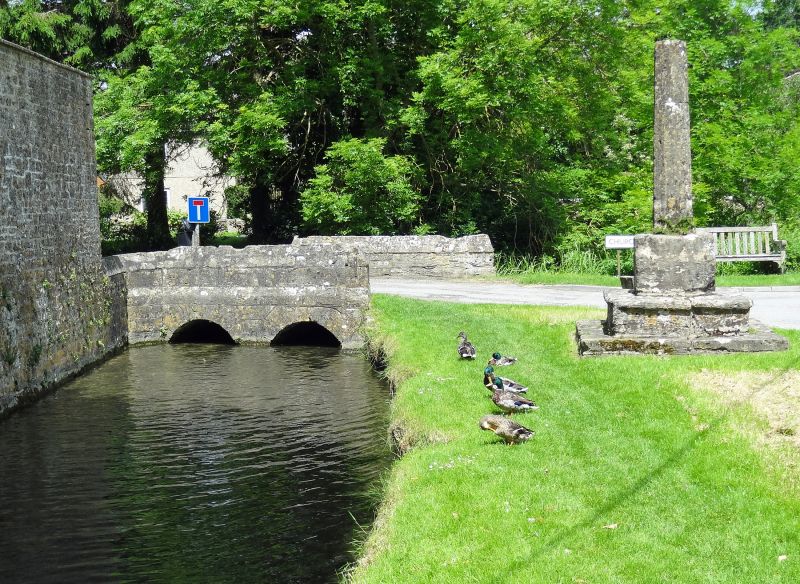
SU 09 SW ASHTON KEYNES CHURCH WALK
(south side)
10/30 Gumstool Bridge
17.1.55
GV II
Bridge over River Thames. Probably late medieval. Limestone. Two
arches, vertical sides rising to form parapet 80cm high.
Triangular copings with raised squared apex. Parapet splayed at
ends.
Listing NGR: SU0450994207
External links are from the relevant listing authority and, where applicable, Wikidata. Wikidata IDs may be related buildings as well as this specific building. If you want to add or update a link, you will need to do so by editing the Wikidata entry.


Other nearby listed buildings
