Latitude: 54.2943 / 54°17'39"N
Longitude: -1.8186 / 1°49'7"W
OS Eastings: 411901
OS Northings: 488756
OS Grid: SE119887
Mapcode National: GBR HLRS.2C
Mapcode Global: WHC6Y.1B88
Plus Code: 9C6W75VJ+PG
Entry Name: Middleham Bridge
Listing Date: 25 June 1985
Grade: II
Source: Historic England
Source ID: 1130935
English Heritage Legacy ID: 321655
ID on this website: 101130935
Location: North Yorkshire, DL8
County: North Yorkshire
District: Richmondshire
Civil Parish: Middleham
Traditional County: Yorkshire
Lieutenancy Area (Ceremonial County): North Yorkshire
Tagged with: Bridge
SE 18 NW MIDDLEHAM A6108
3/47 Middleham Bridge
II
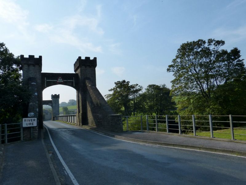
Suspension bridge, now road deck-bridge. Dated 1830, altered 1865. By Hansom and Welch. Coursed rubble and ashlar, cast and wrought iron. Each abutment consists of 2 rubble pylons and rear buttressing walls. Each pylon is rectangular in plan and has a battered base; a turret with a loop-hole on inner-facing and river-facing sides, the inner ones originally for suspension cables; and castellated parapets projecting on ashlar corbels. Each pair of pylons joined by a 4-centred chamfered ashlar arch carrying a rubble wall with, on inner faces, 2 blank ashlar shields and a panel. Northern panel inscribed 'THIS BRIDGE was erected by Voluntary Subscription A.D. 1830, RALPH RIDDELL ESQr. of Cheeseburgh Grange, Northumberland having very generously contributed thereto thro' the medium of Mr. J. DOUTHWAITE his Agent by a gift of the land on which the North Abutment and Wing Walls are built. Messrs. HANSOM & WELCH, Architects'. Cast-and wrought-iron bridge deck supported on 2 cast-iron columns into river bed. Wrought-iron parapets, on inner sides panels cast 'HEAD, ASHBY & Co. ENGINEERS 1865 STOCKTON-ON-TEES'. The suspension structure was damaged soon after construction, it is said by the unlikely phenomena of a herd of cattle, which were being driven across the bridge, getting into step. It was repaired, but eventually replaced by the present deck in 1865.
Listing NGR: SE1190088754
External links are from the relevant listing authority and, where applicable, Wikidata. Wikidata IDs may be related buildings as well as this specific building. If you want to add or update a link, you will need to do so by editing the Wikidata entry.


Other nearby listed buildings