Approximate Location Map
Large Map »
Latitude: 51.4004 / 51°24'1"N
Longitude: -2.3022 / 2°18'7"W
OS Eastings: 379075
OS Northings: 166867
OS Grid: ST790668
Mapcode National: GBR 0QD.0SX
Mapcode Global: VH96N.12S7
Plus Code: 9C3VCM2X+54
Entry Name: 48, High Street
Listing Date: 1 February 1956
Last Amended: 19 October 1983
Grade: II
Source: Historic England
Source ID: 1115284
English Heritage Legacy ID: 32236
ID on this website: 101115284
Location: Bathford, Bath and North East Somerset, Somerset, BA1
County: Bath and North East Somerset
Civil Parish: Bathford
Built-Up Area: Bath
Traditional County: Somerset
Lieutenancy Area (Ceremonial County): Somerset
Tagged with: Building
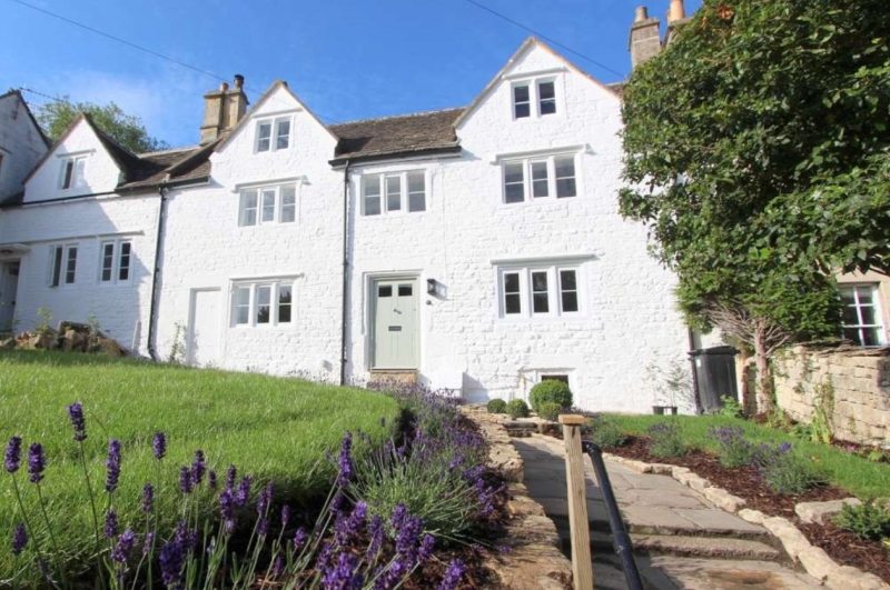
ST 7866-7966 BATHFORD C.P. HIGH STREET
(South-west side)
9/66
1.2.56 No 48
(formerly listed as Highway
G.V. Cottage)
II
Pair of houses, now one. Mid - late C17th. Painted rubble. Cotswold stone
slate roof. 2 storeys and attics in 2 gables. 3 windows: 2- and 3-light
casements with moulded stone mullions, some under drip moulds. 6 panel door to
right, blocked door to left.
Listing NGR: ST7907566867
External links are from the relevant listing authority and, where applicable, Wikidata. Wikidata IDs may be related buildings as well as this specific building. If you want to add or update a link, you will need to do so by editing the Wikidata entry.


Other nearby listed buildings
