Latitude: 54.4975 / 54°29'51"N
Longitude: -1.6893 / 1°41'21"W
OS Eastings: 420220
OS Northings: 511402
OS Grid: NZ202114
Mapcode National: GBR JJNF.2J
Mapcode Global: WHC61.06VY
Plus Code: 9C6WF8X6+27
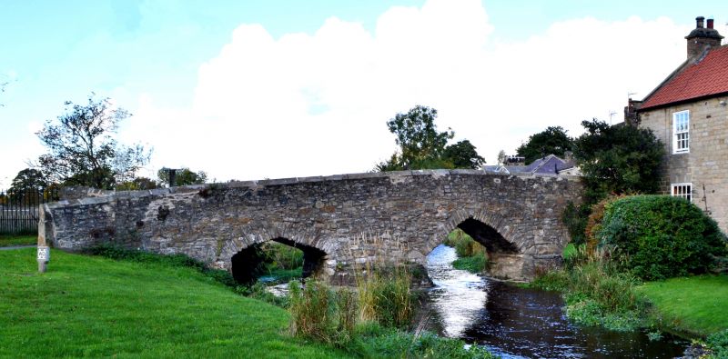
Entry Name: Packhorse Bridge over Aldbrough Beck
Listing Date: 4 February 1969
Grade: II
Source: Historic England
Source ID: 1316888
English Heritage Legacy ID: 323218
ID on this website: 101316888
Location: Aldbrough St John, North Yorkshire, DL11
County: North Yorkshire
District: Richmondshire
Civil Parish: Aldbrough
Built-Up Area: Aldbrough St John
Traditional County: Yorkshire
Lieutenancy Area (Ceremonial County): North Yorkshire
Church of England Parish: Aldbrough
Church of England Diocese: Leeds
ALDBROUGH CHAPEL GREEN
NZ 2011-2111
11/6 Aldbrough St John
Packhorse Bridge over
Aldbrough Beck
4.2.69
GV II
Bridge. Possibly C16 or C17. Rubble. 3 uneven segmental pointed arches,
the dividing piers of uneven size on concrete bases. Triangular coping to
parapets, that on downstream side terminating in monolithic, roughly-shaped
stone to south. Very narrow pathway with C20 concrete surface. Scheduled
as an ancient monument.
Listing NGR: NZ2022011402


Other nearby listed buildings