Latitude: 54.009 / 54°0'32"N
Longitude: -1.4749 / 1°28'29"W
OS Eastings: 434507
OS Northings: 457126
OS Grid: SE345571
Mapcode National: GBR LQ42.GM
Mapcode Global: WHD9L.9HWG
Plus Code: 9C6W2G5G+J2
Entry Name: High Bridge over River Nidd
Listing Date: 5 February 1952
Last Amended: 12 December 1985
Grade: II
Source: Historic England
Source ID: 1149905
English Heritage Legacy ID: 330781
ID on this website: 101149905
Location: Tentergate, North Yorkshire, HG5
County: North Yorkshire
District: Harrogate
Civil Parish: Knaresborough
Built-Up Area: Knaresborough
Traditional County: Yorkshire
Lieutenancy Area (Ceremonial County): North Yorkshire
Church of England Parish: Knaresborough
Church of England Diocese: Leeds
SE 3457 KNARESBOROUGH HIGH BRIDGE
6/112 High Bridge over River Nidd (formerly listed as 5.2.52 High Bridge)
GV II
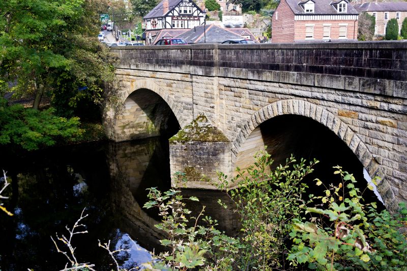
Bridge. Rebuilt 1773, with C19 and C20 widening and restoration. Coursed squared gritstone. 2 segmental arches with rock-faced voussoirs. Pointed cutwaters to both sides. Original narrow arches have chamfered ribs and may be medieval. Widened twice upstream and footpath built out over cutwaters downstream. The bridge was probably rebuilt as part of the establishment of a network of turnpike roads completed in 1777. B Jennings, Harrogate and Knaresborough, 1970, p 234. J A Patmore, Harrogate and Knaresborough: a study in urban development, 1959 (Thesis kept at Harrogate Public Library.)
Listing NGR: SE3450757126


Other nearby listed buildings