Latitude: 54.2808 / 54°16'50"N
Longitude: -1.2964 / 1°17'47"W
OS Eastings: 445905
OS Northings: 487467
OS Grid: SE459874
Mapcode National: GBR MLDY.36
Mapcode Global: WHD8B.1NXM
Plus Code: 9C6W7PJ3+8C
Entry Name: Kirby Knowle Castle
Listing Date: 1 May 1952
Last Amended: 2 February 1990
Grade: II
Source: Historic England
Source ID: 1190919
English Heritage Legacy ID: 332563
Also known as: Kirkby Knowle Castle
ID on this website: 101190919
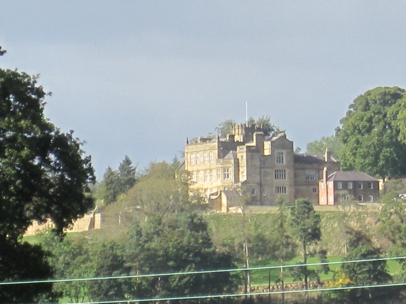
KIRBY KNOWLE WHINMOOR HILL SE 48 NE (NORTH SIDE, OFF) 4/29 KIRBY KNOWLE CASTLE (formerly listed as 1.5.52 New Building) GV II Marked on O.S. Map as Newbygill. Large house. Mid C17 for James Danby with C16 origins; thoroughly restored 1875, and altered 1875. Ashlar, Welsh slate roofs. 3-Storey, 4-bay main block with 2-storey canted bay added to right in front of a further 2 bays which extend rearwards beyond the main range and has another block to the north (altered C20); in the rear angle so formed is a 5-stage tower; at the left (west) end of the main block is a further, lower, 2-storey 1 x 2-bay addition. Chamfered plinth, double-chamfered mullion-and-transom windows, continuous dripmoulds between floors, high panelled parapet screening roof with semi-circular crenellations and obelisk corner finials. South front; cross windows to main range and to each face of canted bay which has an openwork parapet and conical roof. Stacks at ends of blocks. Tower rises above roof line. Rear: quoined lower has a double-chamfered window to all but 5th stage and lowest stage which has a 2-light C19 window above a blocked segmental-arched opening; double-chamfered window to each floor of right return; parapet is corbelled and has moulded panels divided by baluster-like pilasters with finials and central semicircular crenellations. The 2 bays to right of tower have cross-windows to ground floor and transomed 3-light windows above; the 2nd floor dripmould has decorative head-stops. The added bay on right has a cross-window to ground floor and round window in lozenge above. Left return: the addition has a C19 single-storey porch with segment-headed doorway and corniced parapet; cross windows; 2 heart-shaped openings at eaves level and 2 crow-stepped gables. Right return: transomed windows of 2, 3, and 4 lights; a chamfered doorway to centre of left-hand block. Interior not inspected, but VCH notes an oak stair in the tower (VCH, p.45). A castle is said to have been built on this site in the late C13 by Roger Lascelles, but it burnt down c1568 while owned by Sir John Constable. Before he could finish the repair work Constable died and it was not until the 1650s that reconstruction began again, for James Danby. Danby repaired the old parts, built the south front and west wing and changed the name to New Building. By the late C17 the house had passed to the Rokeby family. (W. Grainge, pp. 238-247; VCH, P.45) W. Grainge, The Vale of Mowbray: a historical and topographical account of Thirsk and its Neighbourhood (1859). Victoria County History, North Yorkshire, Vol II.
Listing NGR: SE4590587467
External links are from the relevant listing authority and, where applicable, Wikidata. Wikidata IDs may be related buildings as well as this specific building. If you want to add or update a link, you will need to do so by editing the Wikidata entry.


Other nearby listed buildings