Latitude: 54.1289 / 54°7'44"N
Longitude: -1.1459 / 1°8'45"W
OS Eastings: 455909
OS Northings: 470680
OS Grid: SE559706
Mapcode National: GBR NNFP.QN
Mapcode Global: WHD95.CHK1
Plus Code: 9C6W4VH3+HJ
Entry Name: Crayke Castle
Listing Date: 28 February 1952
Last Amended: 17 May 1960
Grade: I
Source: Historic England
Source ID: 1189213
English Heritage Legacy ID: 333416
Also known as: Crayke Castle: a motte and bailey and later stone castle of the bishops of Durham, incorporating part of an Anglo-Saxon monastic
ID on this website: 101189213
Location: Crayke, North Yorkshire, YO61
County: North Yorkshire
District: Hambleton
Civil Parish: Crayke
Traditional County: Yorkshire
Lieutenancy Area (Ceremonial County): North Yorkshire
Church of England Parish: Crayke St Cuthbert
Church of England Diocese: York
Tagged with: Castle Motte-and-bailey castle
SE 57 SE CRAYKE CHURCH HILL 2/16 (north side) 28.2.52 Crayke Castle (formerly listed as Crayke Castle and 17.5.60 ruins in grounds of Crayke Castle) GV I
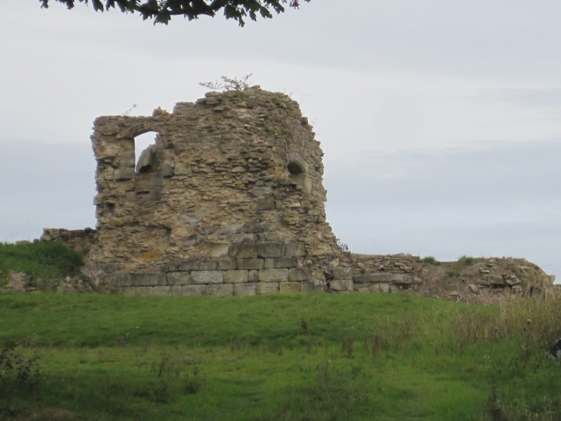
Tower house with attached kitchen range to rear on which the vaulted undercroft alone survives and ruins on a further range - 'The New Tower'. Main range: Early C15 with C18 and C19 alterations and additions, it was built before the kitchen range which is documented to 1441-50. New Tower: probably second half C15. For the Bishops of Durham. Dressed sandstone. Roof of main range concealed, lead roof to kitchen. Main range: rectangular block 70 ft 9 ins x 28 ft 4 ins. Four storeys, each being set back slightly. Bands to floor levels and battlements. Tall, narrow chamfered square headed windows. The entrance to the south side is an C18 alteration, the original entrance being by an external staircase range on the north-east side (now disappeared) to the principal room at 1st floor level. The blocked doorways are 2-centred with hollow chamfers. C19 range attached to north-east. Interior is now subdivided but the moulded cross-beamed ceilings are intact. Fireplaces to ground and 1st floors. C18 features: a cut-string staircase with 2 turned or twisted balusters per tread and curtail with turned newel. Kitchen range: The west wall is partly rebuilt in later materials but has a corbelled-out embattled round turret for spiral staircase to the north-west corner. Chamfered doorway with key block. Interior: tunnel vaulted with 13 heavy unmoulded transverse arches or ribs. Now subdivided. (The undercroft is at ground floor level.) The New Tower: Completely detached building, now ruinous. Once a 3-storey L-shaped block (ground plan 1566-1570). All that remains are the barrel-vaulted undercrofts, stairs to 1st floor level and the walls of the porch. To rear of kitchen remains of foundations of a building that was described as The Old Hall in 1441. Stands on site of Norman Castle. Dismantled in 1647. In the C18 the main range was used as a farmhouse. Pevsner, N., Yorkshire, North Riding, 1966, p 131. Victoria County History, North Yorkshire, Vol II, 1923, p 119 ff.
Listing NGR: SE5590970680
External links are from the relevant listing authority and, where applicable, Wikidata. Wikidata IDs may be related buildings as well as this specific building. If you want to add or update a link, you will need to do so by editing the Wikidata entry.


Other nearby listed buildings