Latitude: 54.5682 / 54°34'5"N
Longitude: -1.5328 / 1°31'58"W
OS Eastings: 430301
OS Northings: 519321
OS Grid: NZ303193
Mapcode National: GBR KHQM.Y6
Mapcode Global: WHC5Q.FF9S
Plus Code: 9C6WHF98+7V
Entry Name: Ketton Packhorse Bridge
Listing Date: 6 June 1952
Grade: II
Source: Historic England
Source ID: 1185904
English Heritage Legacy ID: 350387
ID on this website: 101185904
Location: Darlington, County Durham, DL1
County: Darlington
Civil Parish: Brafferton
Traditional County: Durham
Lieutenancy Area (Ceremonial County): County Durham
Church of England Parish: Great Aycliffe
Church of England Diocese: Durham
BRAFFERTON KETTON LANE NZ 31 NW 303193 (South side, off)
5/16 Ketton Packhorse 6/6/52 Bridge
II
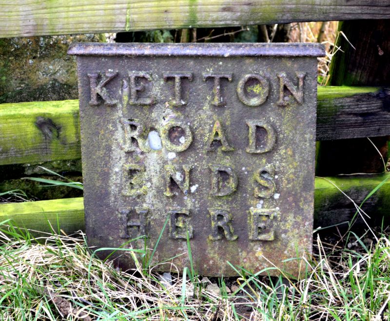
Packhorse bridge. Late C17-early C18. Squared sandstone with dressed voussoirs. Both faces similar. Low and narrow hump-backed bridge. Segmental arch with chamfered intrados has raised keystone and wide arch band. Slightly curved parapet, raked to either side of apex, has projecting coping stones. Added splayed end walls. Small cast-iron plaque at south end has raised letters: KETTON ROAD ENDS.
Scheduled Ancient Monument.
Listing NGR: NZ3030119321


Other nearby listed buildings