Approximate Location Map
Large Map »
Latitude: 52.3048 / 52°18'17"N
Longitude: -0.8943 / 0°53'39"W
OS Eastings: 475490
OS Northings: 267987
OS Grid: SP754679
Mapcode National: GBR BVH.GQF
Mapcode Global: VHDRS.GB3G
Plus Code: 9C4X8434+W7
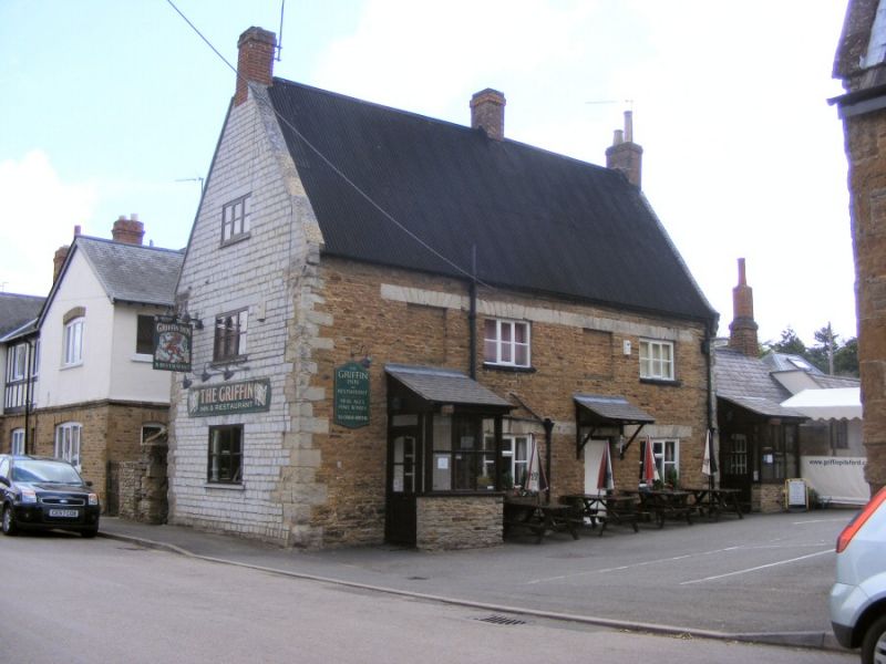
Entry Name: Griffin Inn
Listing Date: 2 November 1954
Grade: II
Source: Historic England
Source ID: 1280252
English Heritage Legacy ID: 360230
Also known as: The Griffin Inn, Northampton
ID on this website: 101280252
Location: Pitsford, West Northamptonshire, NN6
County: West Northamptonshire
Civil Parish: Pitsford
Built-Up Area: Pitsford
Traditional County: Northamptonshire
Lieutenancy Area (Ceremonial County): Northamptonshire
Church of England Parish: Pitsford All Saints
Church of England Diocese: Peterborough
SP76NE PITSFORD HIGH STREET
(South side)
9/241 Griffin Inn
02/11/54
- II
Public house. Late C18. Regular coursed lias with corrugated iron roof,
formerly thatched. 3-unit plan. 2 storeys with attic, 4-window range of 2 C19
casements and blind all with continuous flat ashlar arch heads. 2 entrances
between windows with C20 doors and porches. Ashlar gable parapets and
kneelers. Brick stacks at ridge and end, left gable abutting the road is
limestone ashlar. Interior: Right room has fireplace with bressumer.
Listing NGR: SP7549067986
External links are from the relevant listing authority and, where applicable, Wikidata. Wikidata IDs may be related buildings as well as this specific building. If you want to add or update a link, you will need to do so by editing the Wikidata entry.


Other nearby listed buildings
