Latitude: 52.5863 / 52°35'10"N
Longitude: -2.1426 / 2°8'33"W
OS Eastings: 390435
OS Northings: 298734
OS Grid: SO904987
Mapcode National: GBR 19K.48
Mapcode Global: WHBFZ.18Z2
Plus Code: 9C4VHVP4+GX
Entry Name: Lansdowne Terrace
Listing Date: 31 March 1992
Grade: II
Source: Historic England
Source ID: 1208435
English Heritage Legacy ID: 378593
ID on this website: 101208435
Location: Whitmore Reans, Wolverhampton, West Midlands, WV3
County: City of Wolverhampton
Electoral Ward/Division: Park
Parish: Non Civil Parish
Built-Up Area: Wolverhampton
Traditional County: Staffordshire
Lieutenancy Area (Ceremonial County): West Midlands
Church of England Parish: Central Wolverhampton
Church of England Diocese: Lichfield
Tagged with: Building
WOLVERHAMPTON
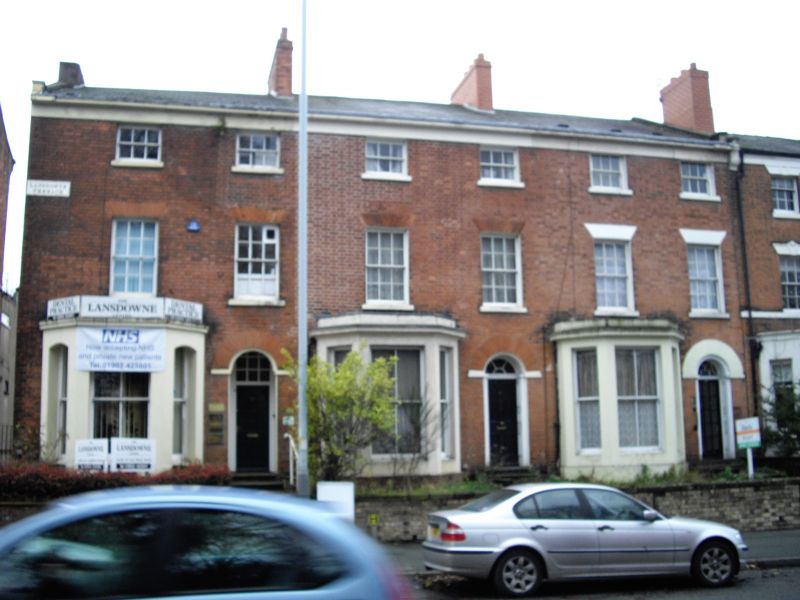
SO99NW TETTENHALL ROAD 895-1/5/333 (South side) Nos.39, 41 AND 43 Lansdowne Terrace
GV II
Terrace of 3 houses. c1835. Brick with ashlar dressings; slate roof with brick stacks. Double-depth plan. 3 storeys; 6-window range. Top frieze and cornice; coped gables with kneelers. Ground floor has canted bay windows with cornices and blocking courses, and later 4-pane sashes; windows to 1st floor have rubbed brick flat arches over 12-pane sashes; 2nd floor windows have 6-pane sashes. Round-headed entrances have panelled reveals, 41 has 4-panelled door 39 and 43 have C20 doors and fanlights with glazing bars; entrance to No 39 is recessed with small-paned overlight. 2 cross-axial stacks. Ashlar plaque with name to 1st floor left end. INTERIOR: No 33 has stick-baluster staircase. An example of mid C19 suburban development in Wolverhampton.
Listing NGR: SO9043598734
External links are from the relevant listing authority and, where applicable, Wikidata. Wikidata IDs may be related buildings as well as this specific building. If you want to add or update a link, you will need to do so by editing the Wikidata entry.


Other nearby listed buildings