Approximate Location Map
Large Map »
Latitude: 52.2045 / 52°12'16"N
Longitude: -3.0384 / 3°2'18"W
OS Eastings: 329135
OS Northings: 256762
OS Grid: SO291567
Mapcode National: GBR F4.3BYY
Mapcode Global: VH778.9V2D
Plus Code: 9C4R6X36+RJ
Entry Name: Church of St Mary
Listing Date: 8 October 1953
Grade: I
Source: Historic England
Source ID: 1208031
English Heritage Legacy ID: 385797
Also known as: St. Mary the Virgin Church
St Mary, Kington
St Mary's, Kington
ID on this website: 101208031
Location: St Mary's Church, Newton, County of Herefordshire, HR5
County: County of Herefordshire
Civil Parish: Kington
Built-Up Area: Kington
Traditional County: Herefordshire
Lieutenancy Area (Ceremonial County): Herefordshire
Church of England Parish: Kington
Church of England Diocese: Hereford
Tagged with: Church building
SO2956 ; 643-1/1/37
KINGTON,
CHURCH ROAD (North-West side),
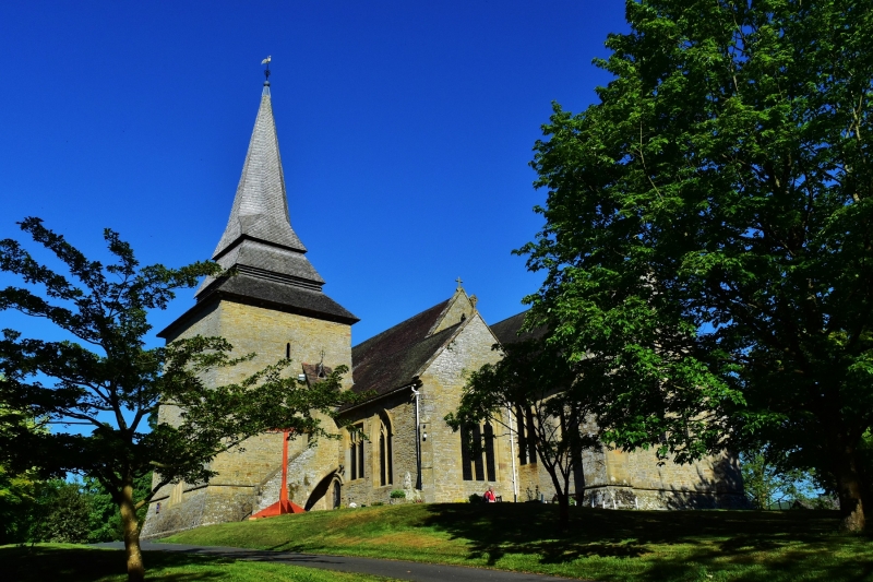
Church of St Mary
08/10/53
GV
I
Parish church. c1300, much altered. Sandstone rubble; plain
tile roof with shingles to spire. Nave, north and south aisles
(c1300), chancel (rebuilt early C14), Decorated south chapel
(c1320), south porch (early C14), tower, with double-broach
spire (rebuilt 1794); outer north aisle (c1874). Nave (rebuilt
early C14 with added aisle): arcades of five bays with octagonal
piers and double-chamfered arches. One original lancet survives
in south wall; C13 window reset in north wall of outer aisle.
Chancel has group of three stepped lancets to east and six smaller
lancets to north.
INTERIOR: round arch with roll moulding from
tower to south aisle; Norman circular font with rope moulding
and incised zig-zag. Monuments: Thomas Vaughan, d.1469 and
wife Elena: alabaster effigies on tomb-chest with ten by four alabaster angels (front and foot end) upright and holding
shields; William Matthews, d.1688: tablet with columns and, at
top, 2 standing putti; C18 and C19 commemorative tablets.
(RCHME: Herefordshire: 89).
Listing NGR: SO2913456764
External links are from the relevant listing authority and, where applicable, Wikidata. Wikidata IDs may be related buildings as well as this specific building. If you want to add or update a link, you will need to do so by editing the Wikidata entry.


Other nearby listed buildings
