Latitude: 54.9003 / 54°54'0"N
Longitude: -2.9363 / 2°56'10"W
OS Eastings: 340055
OS Northings: 556572
OS Grid: NY400565
Mapcode National: GBR 7CYS.35
Mapcode Global: WH802.V3Y6
Plus Code: 9C6VW327+4F
Entry Name: Eden Bridge
Listing Date: 1 June 1949
Grade: I
Source: Historic England
Source ID: 1297364
English Heritage Legacy ID: 386570
ID on this website: 101297364
Location: Stanwix, Cumberland, Cumbria, CA3
County: Cumberland
District: Carlisle
Parish: Non Civil Parish
Built-Up Area: Carlisle
Traditional County: Cumberland
Lieutenancy Area (Ceremonial County): Cumbria
Church of England Parish: Carlisle Stanwix St Michael
Church of England Diocese: Carlisle
Tagged with: Road bridge
CARLISLE
NY4056 Eden Bridge 671-1/7/123 01/06/49
GV I
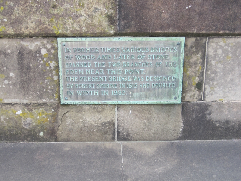
Road bridge over River Eden. 1812-15, for the County of Cumberland by Robert Smirke, with various minor alterations and 1932 widening by Percy Dalton, City Engineer. Reeded calciferous sandstone ashlar. 5 segmental arches of double width, on rounded piers, with flush voussoirs, string course and solid parapet. North to south alignment. Abutments project at either side on the south and the north-west but replaced by steps on north-east as an entrance to Rickerby Park; the recesses in the parapets above the abutments have a stone seat with flanking rectangular cast-iron gas lamp brackets now surmounted by C20 electric light globes. A pedestrian tunnel was cut through the south in 1902, lined with white glazed bricks; external stone steps were added on the south-west side to reach the tunnel; a ramp gives access at the other side. Under the arches can be seen the cleaner stonework of the extension on the east side which has a face exactly matching that on the west but of new stone. Cut onto the south-west abutment are the various flood dates and levels, but most are now weathered - DEC 13TH 1852 and 1857 are visible. Fixed onto the bridge parapet are various bronze plaques giving a brief history and a central one recording the widening. Under the arches in the river bed are the remains of a C16 bridge and its associated piling discovered during dredging in 1951. For history of site see Hogg CWAAS, Trans.NS LII and Macdonald, CWAAS, Trans.NS LXXI. This was one of the two bridges built together but the southern channel of the river was left dry and gradually filled; the southern bridge was demolished in 1969-70 to make way for the inner ring road. A Scheduled Ancient Monument. (Cumb. & West. Antiquarian & Archaeological Soc., New Series: Hogg, Robert: LII: The Historic Crossings of the River Eden: P.131-159; Cumb. & West. Antiquarian & Archaeological Soc., New Series: MacDonald MIM: LXXI: The building of the New Eden Bridge: P.248-259).
Listing NGR: NY4005556571
External links are from the relevant listing authority and, where applicable, Wikidata. Wikidata IDs may be related buildings as well as this specific building. If you want to add or update a link, you will need to do so by editing the Wikidata entry.


Other nearby listed buildings