Latitude: 53.4816 / 53°28'53"N
Longitude: -2.233 / 2°13'58"W
OS Eastings: 384633
OS Northings: 398343
OS Grid: SJ846983
Mapcode National: GBR DMG.5Y
Mapcode Global: WHB9G.NRV9
Plus Code: 9C5VFQJ8+JQ
Entry Name: Bradley House
Listing Date: 6 June 1994
Grade: II
Source: Historic England
Source ID: 1197772
English Heritage Legacy ID: 388065
ID on this website: 101197772
Location: Ancoats, Manchester, Greater Manchester, M1
County: Manchester
Electoral Ward/Division: City Centre
Parish: Non Civil Parish
Built-Up Area: Manchester
Traditional County: Lancashire
Lieutenancy Area (Ceremonial County): Greater Manchester
Church of England Parish: Manchester Cathedral
Church of England Diocese: Manchester
Tagged with: Building
MANCHESTER
SJ8498SE DALE STREET 698-1/29/82 (North East side) No.33 Bradley House
GV II
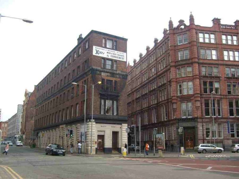
Shipping warehouse, now various workshops and offices. Later C19, probably for Kessler & Co., merchants. Blackened sandstone ashlar and brown brick in Flemish bond, roof not visible. Wedge-shaped plan on island site between Newton Street on north side and Port Street on south side, with very narrow frontage to Dale Street. Very plain late-Georgian style. Basement and 3+2 storeys, with one-bay facade to Dale Street, 15- and 14-window left and right sides. The basement and ground floor have channelled piers on punched plinths, and a cornice band, a similar band divides the 2nd and 3rd floors, and the parapet has a simple moulded coping. The narrow front has an altered ground floor with 2 doors, and tripartite sashed windows on each floor above, that at 1st floor with a stone frame and cornice but the others in plain brick (a large signboard between those at 3rd and 4th floors). The sides have similar plain tripartite sashes at the ends and plain 4-pane sashes between; a loading entrance to the rear; cast iron railings to the basement windows (except 6 nearest the front end, which are blocked); one chimney near the west end of the north side and another in the centre of the south side. Interior not inspected. HISTORY: built on site occupied in 1850 by a machine manufactory.
Listing NGR: SJ8463398343
External links are from the relevant listing authority and, where applicable, Wikidata. Wikidata IDs may be related buildings as well as this specific building. If you want to add or update a link, you will need to do so by editing the Wikidata entry.


Other nearby listed buildings