Approximate Location Map
Large Map »
Latitude: 52.3659 / 52°21'57"N
Longitude: -2.7255 / 2°43'31"W
OS Eastings: 350694
OS Northings: 274455
OS Grid: SO506744
Mapcode National: GBR BK.S3P5
Mapcode Global: VH843.PSZN
Plus Code: 9C4V978F+9Q
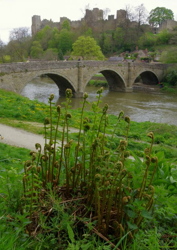
Entry Name: Dinham Bridge
Listing Date: 15 April 1954
Grade: II
Source: Historic England
Source ID: 1202914
English Heritage Legacy ID: 389936
ID on this website: 101202914
Location: Ludlow, Shropshire, SY8
County: Shropshire
Civil Parish: Ludlow
Built-Up Area: Ludlow
Traditional County: Shropshire
Lieutenancy Area (Ceremonial County): Shropshire
Church of England Parish: Ludlow St Laurence
Church of England Diocese: Hereford
Tagged with: Bridge
LUDLOW
SO5074 DINHAM
825-1/3/307 Dinham Bridge
15/04/54
GV II
Bridge and wing walls. Early C19. Rubble with ashlar coping; 4
arches, three with drip courses; semi-circular pilasters over
cutwaters; ashlar band over.
Listing NGR: SO5069474455
External links are from the relevant listing authority and, where applicable, Wikidata. Wikidata IDs may be related buildings as well as this specific building. If you want to add or update a link, you will need to do so by editing the Wikidata entry.


Other nearby listed buildings
