Approximate Location Map
Large Map »
Latitude: 52.9271 / 52°55'37"N
Longitude: -1.4751 / 1°28'30"W
OS Eastings: 435384
OS Northings: 336766
OS Grid: SK353367
Mapcode National: GBR PKD.R1
Mapcode Global: WHDGT.9PTB
Plus Code: 9C4WWGGF+VX
Entry Name: St Marys Bridge
Listing Date: 20 June 1952
Grade: II*
Source: Historic England
Source ID: 1215897
English Heritage Legacy ID: 401092
Also known as: St Mary's Bridge
ID on this website: 101215897
Location: Derby, Derbyshire, DE1
County: City of Derby
Electoral Ward/Division: Darley
Parish: Non Civil Parish
Built-Up Area: Derby
Traditional County: Derbyshire
Lieutenancy Area (Ceremonial County): Derbyshire
Church of England Parish: Chester Green St Paul
Church of England Diocese: Derby
Tagged with: Road bridge
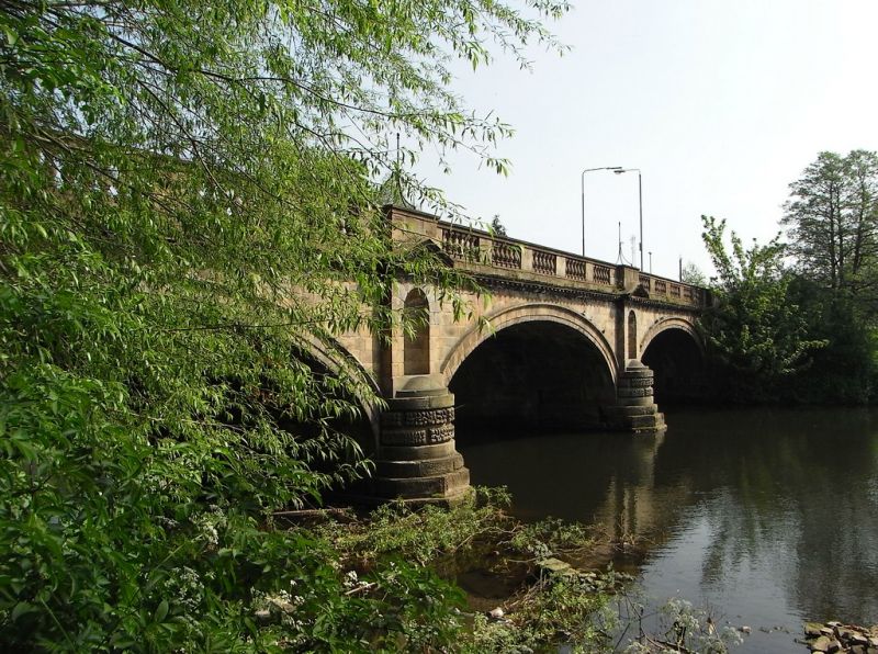
BRIDGE GATE
1.
5170
St Mary's Bridge
SK 3536 NW 2/39 20.6.52.
II* GV
2.
C18. A stone bridge of 3 arches, divided by buttresses each with a small pedimented
niche. Modillion cornice and balustraded parapet. AM.
St Mary's Bridge Chapel, No 86 and St Mary's Bridge form a group.
Listing NGR: SK3538436766
External links are from the relevant listing authority and, where applicable, Wikidata. Wikidata IDs may be related buildings as well as this specific building. If you want to add or update a link, you will need to do so by editing the Wikidata entry.


Other nearby listed buildings
