Latitude: 53.0837 / 53°5'1"N
Longitude: -2.8797 / 2°52'46"W
OS Eastings: 341173
OS Northings: 354412
OS Grid: SJ411544
Mapcode National: GBR 7B.9P0Y
Mapcode Global: WH88T.QRXC
Plus Code: 9C5V34MC+F4
Entry Name: Farndon Bridge (That Part in Cheshire, Scheduled Ancient Monument)
Listing Date: 1 March 1967
Grade: I
Source: Historic England
Source ID: 1279428
English Heritage Legacy ID: 403439
ID on this website: 101279428
Location: Farndon, Cheshire West and Chester, Cheshire, CH3
County: Cheshire West and Chester
Civil Parish: Farndon
Built-Up Area: Farndon (Cheshire West and Chester)
Traditional County: Cheshire
Lieutenancy Area (Ceremonial County): Cheshire
Church of England Parish: Farndon St Chad
Church of England Diocese: Chester
SJ 45 SW FARNDON C.P. HIGH STREET West End
2/41 Farndon Bridge (that part in Cheshire, a scheduled Ancient Monument ) 1/3/67
- I
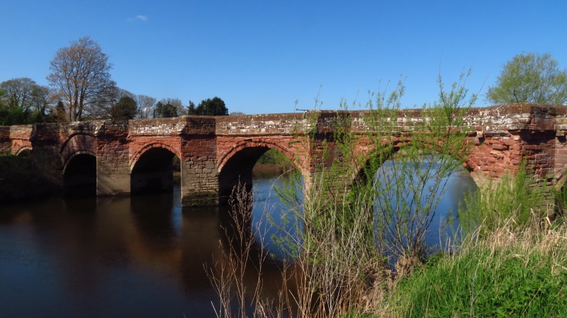
Bridge circa 1345, of red sandstone. 5 arches over river, 1 flood arch on east (Farndon) side and 2 on west (Holt) side in Clwyd. Abutments rebuilt and widened probably early C19. Cutwaters. Deep segmental arches have 2 rings of voussoirs, the inner ring recessed, the outer one chamfered. Projecting cyma-moulded band at road level. The western-most river arch (in Clwyd) has a single ring of voussoirs rising into the parapet above a flatter (C20?) lower arch. According to tradition, the bridge was fortified and this altered arch may replace a draw-span. The western (Clwyd) abutment, at an angle to the bridge, has a rebuilt eastern flood-arch. Moulded band removed from abutments/flood arches. Late C20 mild steel rail of 1 bar on each plain, flush-coped parapet. Between the flood-arches and abutments the medieval bridge is unwidened and little altered.
Listing NGR: SJ4117354412


Other nearby listed buildings