Approximate Location Map
Large Map »
Latitude: 55.5828 / 55°34'57"N
Longitude: -1.6529 / 1°39'10"W
OS Eastings: 421981
OS Northings: 632177
OS Grid: NU219321
Mapcode National: GBR J3WW.YK
Mapcode Global: WHC0M.LY42
Plus Code: 9C7WH8MW+4V
Entry Name: Limekilns at Seahouses Harbour
Listing Date: 22 December 1969
Grade: II
Source: Historic England
Source ID: 1234465
English Heritage Legacy ID: 410383
ID on this website: 101234465
Location: Seahouses, Northumberland, NE68
County: Northumberland
Civil Parish: North Sunderland
Built-Up Area: Seahouses
Traditional County: Northumberland
Lieutenancy Area (Ceremonial County): Northumberland
Church of England Parish: North Sunderland St Paul
Church of England Diocese: Newcastle
Tagged with: Lime kiln
NORTH SUNDERLAND SEAHOUSES
NU 23 SW
9/186 Limekilns at
22.12.69 Seahouses Harbour
II
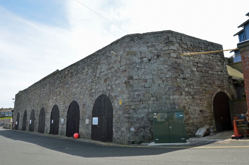
Limekilns. Probably late C18. Ashlar. 7 large round arches now with boarded
double doors. Canted corner on right. Two more arches on left return.
Interiors of arches are corbelled down to small round-headed drawing eyes.
Listing NGR: NU2198732147
External links are from the relevant listing authority and, where applicable, Wikidata. Wikidata IDs may be related buildings as well as this specific building. If you want to add or update a link, you will need to do so by editing the Wikidata entry.


Other nearby listed buildings
