Approximate Location Map
Large Map »
Latitude: 50.9558 / 50°57'20"N
Longitude: 0.4686 / 0°28'6"E
OS Eastings: 573473
OS Northings: 120276
OS Grid: TQ734202
Mapcode National: GBR PVT.Z54
Mapcode Global: FRA C6WL.0CZ
Plus Code: 9F22XF49+8C
Entry Name: The Parish Church of All Saints
Listing Date: 3 August 1961
Last Amended: 13 May 1987
Grade: II*
Source: Historic England
Source ID: 1275863
English Heritage Legacy ID: 411021
ID on this website: 101275863
Location: All Saint's Church, Mountfield, Rother, East Sussex, TN32
County: East Sussex
District: Rother
Civil Parish: Mountfield
Traditional County: Sussex
Lieutenancy Area (Ceremonial County): East Sussex
Church of England Parish: Mountfield All Saints
Church of England Diocese: Chichester
Tagged with: Church building
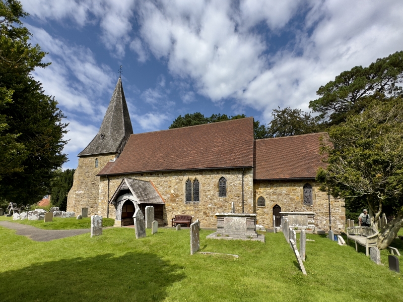
TQ 72 SW MOUNTFIELD CHURCH ROAD
12/21 The Parish Church of All
Saints
(formerly listed as Church
3.8.61 of All Saints)
II*
Chancel, north vestry, nave, south porch and west tower with broached shingled
spire. Nave early C12, chancel and tower late C12, porch C14, vestry C19.
Listing NGR: TQ7347320276
External links are from the relevant listing authority and, where applicable, Wikidata. Wikidata IDs may be related buildings as well as this specific building. If you want to add or update a link, you will need to do so by editing the Wikidata entry.


Other nearby listed buildings
