Latitude: 51.2199 / 51°13'11"N
Longitude: 1.3361 / 1°20'10"E
OS Eastings: 633062
OS Northings: 152034
OS Grid: TR330520
Mapcode National: GBR X1V.GM0
Mapcode Global: VHLGZ.3LQP
Plus Code: 9F33689P+XF
Entry Name: The New Mill
Listing Date: 11 October 1963
Last Amended: 24 March 1987
Grade: II
Source: Historic England
Source ID: 1237000
English Heritage Legacy ID: 428139
Also known as: New Mill, Northbourne
ID on this website: 101237000
Location: Northbourne, Dover, Kent, CT14
County: Kent
District: Dover
Civil Parish: Northbourne
Traditional County: Kent
Lieutenancy Area (Ceremonial County): Kent
Tagged with: Smock mill
NORTHBOURNE MILL LANE TR 35 SW (north side)
4/25 The New Mill (formerly listed as The New 11.10.63 Windmill)
II
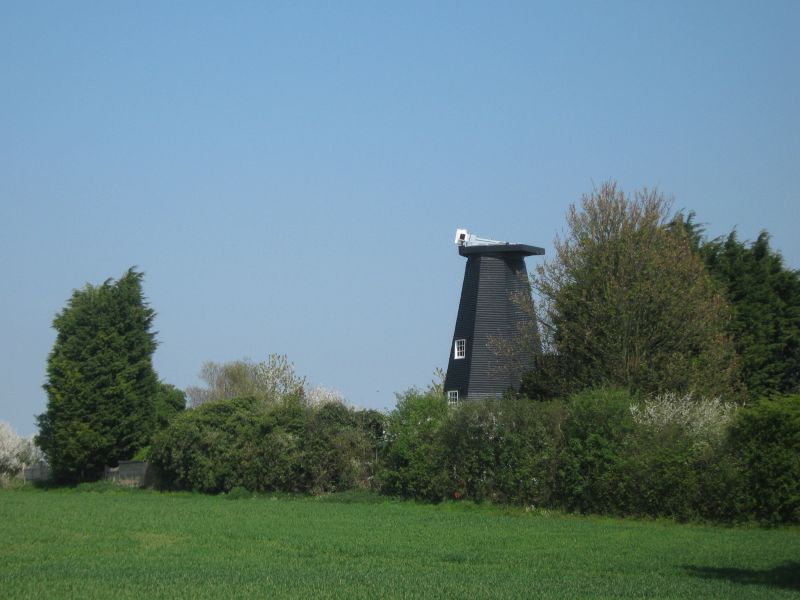
Windmill, now house and workshop. Built 1848 by Holmans of Canterbury for Richard Fuller. Timber framed and weather boarded, with asphalt roof. Smock mill type, with single storey ranges at foot. The sweeps and winding gear are missing, although the windshaft remains. Wooden casements and boarded doors in mill tower and base buildings, now residential.
Listing NGR: TR3306252034
External links are from the relevant listing authority and, where applicable, Wikidata. Wikidata IDs may be related buildings as well as this specific building. If you want to add or update a link, you will need to do so by editing the Wikidata entry.


Other nearby listed buildings