Latitude: 52.8748 / 52°52'29"N
Longitude: -1.1338 / 1°8'1"W
OS Eastings: 458397
OS Northings: 331168
OS Grid: SK583311
Mapcode National: GBR 8JK.N6H
Mapcode Global: WHDH5.KZ9Z
Plus Code: 9C4WVVF8+WF
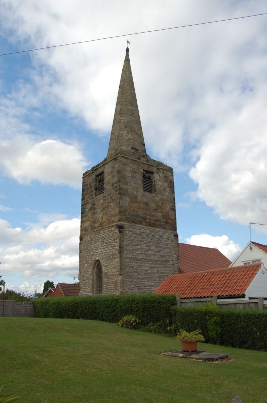
Entry Name: Tower and Spire of Former Church
Listing Date: 13 October 1966
Grade: II
Source: Historic England
Source ID: 1277785
English Heritage Legacy ID: 430428
ID on this website: 101277785
Location: Bradmore, Rushcliffe, Nottinghamshire, NG11
County: Nottinghamshire
District: Rushcliffe
Civil Parish: Bradmore
Traditional County: Nottinghamshire
Lieutenancy Area (Ceremonial County): Nottinghamshire
Tagged with: Tower
BRADMORE MAIN STREET SK 53 SE (north side)
5/23 Tower and Spire of former Church 13.10.66 G.V. II
Tower and spire. C13 and C14. Dressed coursed rubble and ashlar. Tower set on a plinth, of 2 stages, the lower C13 dressed coursed rubble with ashlar quoins, the upper C14 ashlar. Parapet with remains of single gargoyles to each side. C14 broach spire with single rectangular opening to the base. West side of tower with single pointed arched window. The 4 bell chamber openings each of 2 trefoil arched lights under a flat arch, all now lacking mullion. Inner chamfered tower arch. Attached to the east side of the tower is a late C19 mission church, of no special interest. The church was destroyed by the fire of 1705 which destroyed much of Bradmore.
Listing NGR: SK5839731168
External links are from the relevant listing authority and, where applicable, Wikidata. Wikidata IDs may be related buildings as well as this specific building. If you want to add or update a link, you will need to do so by editing the Wikidata entry.


Other nearby listed buildings