Latitude: 52.7875 / 52°47'14"N
Longitude: -2.3649 / 2°21'53"W
OS Eastings: 375485
OS Northings: 321162
OS Grid: SJ754211
Mapcode National: GBR 05G.8WN
Mapcode Global: WH9CR.N61D
Plus Code: 9C4VQJPP+X2
Entry Name: Forton Hall
Listing Date: 15 January 1968
Grade: II*
Source: Historic England
Source ID: 1242679
English Heritage Legacy ID: 443411
ID on this website: 101242679
Location: Forton, Stafford, Staffordshire, TF10
County: Staffordshire
District: Stafford
Civil Parish: Forton
Traditional County: Staffordshire
Lieutenancy Area (Ceremonial County): Staffordshire
Church of England Parish: Forton All Saints
Church of England Diocese: Lichfield
Tagged with: House
FORTON 1. 2385 Forton Hall SJ 72 SE 7/2A 15.1.68. II*
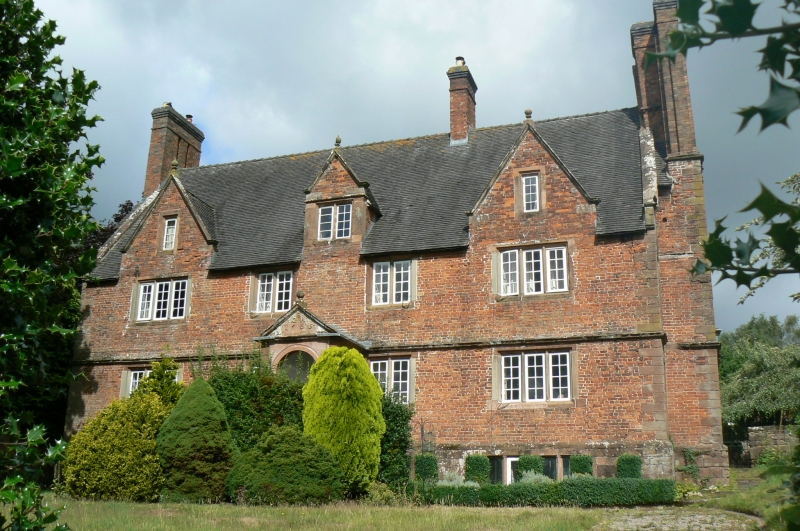
2. Brick lath stone dressings and tiled roof. Large brick stacks; 2 storeys and attic; moulded string course; stone mullioned windows; 3 gables in front; 4 window front; gabled porch with classical doorway and ball finial on gable; forestair; coped gables; dated on porch 1665, with initials S G A. Still in the Jacobean manner. Basement of stone.
Listing NGR: SJ7548521162
External links are from the relevant listing authority and, where applicable, Wikidata. Wikidata IDs may be related buildings as well as this specific building. If you want to add or update a link, you will need to do so by editing the Wikidata entry.


Other nearby listed buildings