Latitude: 51.1966 / 51°11'47"N
Longitude: 0.2086 / 0°12'30"E
OS Eastings: 554410
OS Northings: 146471
OS Grid: TQ544464
Mapcode National: GBR MNX.ZGZ
Mapcode Global: VHHQ5.K6M0
Plus Code: 9F3256W5+JC
Entry Name: The Old Lodge
Listing Date: 16 January 1975
Grade: II
Source: Historic England
Source ID: 1273355
English Heritage Legacy ID: 445266
ID on this website: 101273355
Location: Leigh, Sevenoaks, Kent, TN11
County: Kent
District: Sevenoaks
Civil Parish: Leigh
Built-Up Area: Leigh
Traditional County: Kent
Lieutenancy Area (Ceremonial County): Kent
Church of England Parish: Leigh
Church of England Diocese: Rochester
Tagged with: Gatehouse
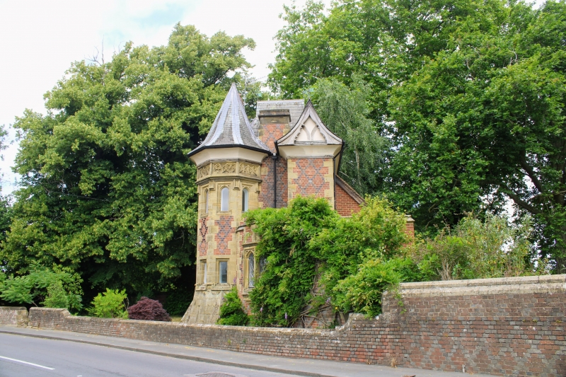
LEIGH LEIGH 1, 52113 High Street (North Side) The Old Lodge TQ 5446 19/670 II 2. Tall, narrow, 2-storey building of mid Cl9 by George Devey. High pitched slated roofs with swept eaves. Projecting octagonal turret with pointed roof. Deep coved eaves soffit. Red brick with diaper of blue headers. Stone dressings including carved band above lst floor windows in turret; and window surrounds and mullions. Fancy leaded casements, some with 4-centred heads.
Listing NGR: TQ5441046471
External links are from the relevant listing authority and, where applicable, Wikidata. Wikidata IDs may be related buildings as well as this specific building. If you want to add or update a link, you will need to do so by editing the Wikidata entry.


Other nearby listed buildings