Approximate Location Map
Large Map »
Latitude: 51.4404 / 51°26'25"N
Longitude: 0.7791 / 0°46'44"E
OS Eastings: 593242
OS Northings: 174936
OS Grid: TQ932749
Mapcode National: GBR RS2.RSF
Mapcode Global: VHKJ7.G272
Plus Code: 9F32CQRH+5J
Entry Name: Cheyney House the Rock House
Listing Date: 2 March 1950
Grade: II
Source: Historic England
Source ID: 1273262
English Heritage Legacy ID: 445680
ID on this website: 101273262
Location: Marine Town, Swale, Kent, ME12
County: Kent
District: Swale
Electoral Ward/Division: Sheerness
Parish: Sheerness
Built-Up Area: Sheerness
Traditional County: Kent
Lieutenancy Area (Ceremonial County): Kent
Tagged with: House
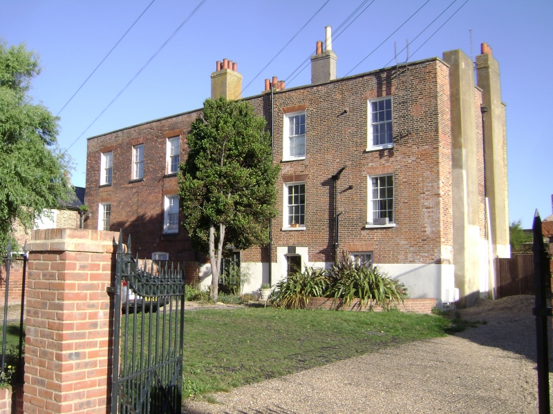
MARINE PARADE
1.
5282
(North Side)
Marine Town, Sheerness
No 124 (The Rock House)
TQ 97 SW 11/77 2.3.50. No 126 (Cheyney House)
II GV
2.
A C18 house facing the sea. 3 storeys brick. Parapet with stone coping and
hidden slate roof. 5 windows to 1st and 2nd floors, internally recessed sashes
with plaster reveals. Two late C18 doors, one with circular traceried fanlight,
square projecting window on 1st floor.
Listing NGR: TQ9324274936
External links are from the relevant listing authority and, where applicable, Wikidata. Wikidata IDs may be related buildings as well as this specific building. If you want to add or update a link, you will need to do so by editing the Wikidata entry.


Other nearby listed buildings
