Latitude: 54.4525 / 54°27'8"N
Longitude: -2.9592 / 2°57'33"W
OS Eastings: 337906
OS Northings: 506764
OS Grid: NY379067
Mapcode National: GBR 7JSY.4P
Mapcode Global: WH826.JC20
Plus Code: 9C6VF22R+X8
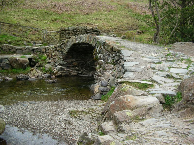
Entry Name: High Sweden Bridge
Listing Date: 12 January 1967
Grade: II
Source: Historic England
Source ID: 1244787
English Heritage Legacy ID: 450575
ID on this website: 101244787
Location: Westmorland and Furness, Cumbria, LA22
County: Westmorland and Furness
District: South Lakeland
Civil Parish: Lakes
Traditional County: Westmorland
Lieutenancy Area (Ceremonial County): Cumbria
Church of England Parish: Ambleside
Church of England Diocese: Carlisle
Tagged with: Bridge Packhorse bridge
1. AMBLESIDE 1291A High Sweden Bridge NY 30 NE 9/4 12.1.67. II 2. Late C17 packhorse bridge, consisting of 5-centred arch without parapets.
Listing NGR: NY3790606764
External links are from the relevant listing authority and, where applicable, Wikidata. Wikidata IDs may be related buildings as well as this specific building. If you want to add or update a link, you will need to do so by editing the Wikidata entry.


Other nearby listed buildings